Latitude: 51.9673 / 51°58'2"N
Longitude: -0.4275 / 0°25'38"W
OS Eastings: 508128
OS Northings: 231032
OS Grid: TL081310
Mapcode National: GBR G45.LR8
Mapcode Global: VHFR1.JTV8
Plus Code: 9C3XXH8F+W2
Entry Name: 69, Bedford Road
Listing Date: 14 March 1975
Grade: II
Source: Historic England
Source ID: 1114645
English Heritage Legacy ID: 35863
ID on this website: 101114645
Location: Barton-le-Clay, Central Bedfordshire, MK45
County: Central Bedfordshire
Civil Parish: Barton-le-Clay
Built-Up Area: Barton-le-Clay
Traditional County: Bedfordshire
Lieutenancy Area (Ceremonial County): Bedfordshire
Church of England Parish: Barton-le-Cley
Church of England Diocese: St.Albans
Tagged with: Building
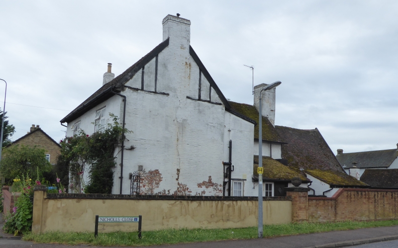
1.
5125 BARTON-LE-CLAY BEDFORD ROAD
(west side)
No 69
TL 03 SE 2/4 14.3.75
II
2.
C17 back wing, timber framed, whitewashed brick infill, old clay tile roof. 18th
century whitewashed brick front, with gable end stacks. Two storeys. Modern casements.
Listing NGR: TL0812831032
External links are from the relevant listing authority and, where applicable, Wikidata. Wikidata IDs may be related buildings as well as this specific building. If you want to add or update a link, you will need to do so by editing the Wikidata entry.


Other nearby listed buildings