Approximate Location Map
Large Map »
Latitude: 51.9655 / 51°57'55"N
Longitude: -0.4266 / 0°25'35"W
OS Eastings: 508195
OS Northings: 230837
OS Grid: TL081308
Mapcode National: GBR G45.LZH
Mapcode Global: VHFR1.KVBM
Plus Code: 9C3XXH8F+59
Entry Name: 10, Bedford Road
Listing Date: 14 March 1975
Grade: II
Source: Historic England
Source ID: 1114646
English Heritage Legacy ID: 35867
ID on this website: 101114646
Location: Barton-le-Clay, Central Bedfordshire, MK45
County: Central Bedfordshire
Civil Parish: Barton-le-Clay
Built-Up Area: Barton-le-Clay
Traditional County: Bedfordshire
Lieutenancy Area (Ceremonial County): Bedfordshire
Church of England Parish: Barton-le-Cley
Church of England Diocese: St.Albans
Tagged with: Building
1.
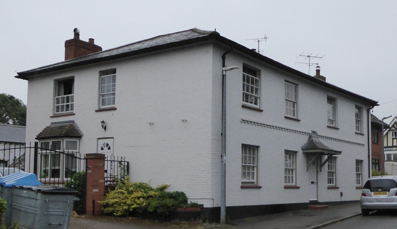
5125 BARTON-LE-CLAY BEDFORD ROAD
(east side)
No 10
TL 03 SE 2/9 14.3.75
II
2.
Included for late C17 or early C18 rear wing. Timber frame with brick infill,
old clay tile roof. L plan: west unit is 2 storey; east with 1 storey and attics
has hipped roof. Front wing is C19.
Listing NGR: TL0819530837
External links are from the relevant listing authority and, where applicable, Wikidata. Wikidata IDs may be related buildings as well as this specific building. If you want to add or update a link, you will need to do so by editing the Wikidata entry.


Other nearby listed buildings
