Latitude: 51.9682 / 51°58'5"N
Longitude: -0.4205 / 0°25'13"W
OS Eastings: 508607
OS Northings: 231152
OS Grid: TL086311
Mapcode National: GBR G45.GJC
Mapcode Global: VHFR1.NSKJ
Plus Code: 9C3XXH9H+7R
Entry Name: Manor Cottage
Listing Date: 14 March 1975
Grade: II
Source: Historic England
Source ID: 1114650
English Heritage Legacy ID: 35880
ID on this website: 101114650
Location: Barton-le-Clay, Central Bedfordshire, MK45
County: Central Bedfordshire
Civil Parish: Barton-le-Clay
Built-Up Area: Barton-le-Clay
Traditional County: Bedfordshire
Lieutenancy Area (Ceremonial County): Bedfordshire
Church of England Parish: Barton-le-Cley
Church of England Diocese: St.Albans
Tagged with: Cottage
1.
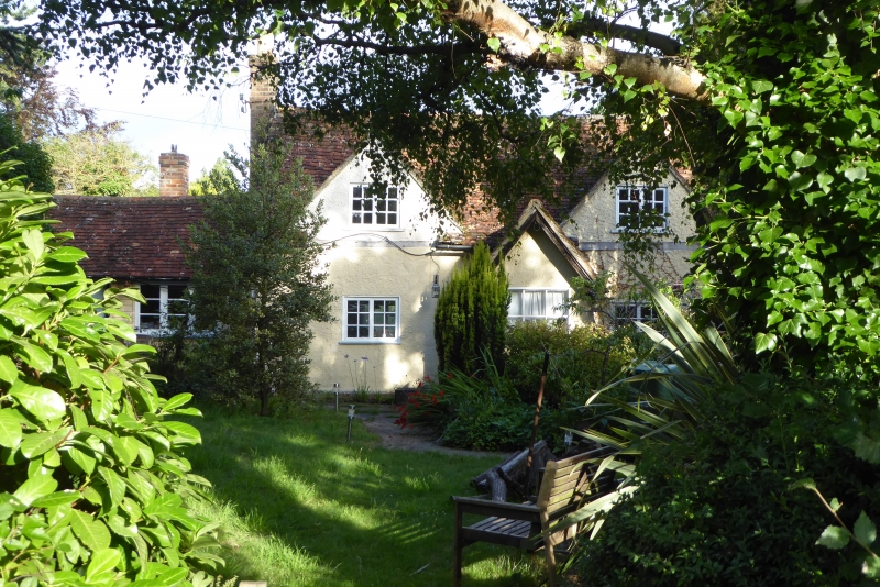
5125 BARTON-LE-CLAY MANOR ROAD
No 80
(Manor Cottage)
TL 03 SE 2/20 14.3.75
II
2.
C18 cottage. Colour washed roughcast over timber frame. Old clay tile roof.
Two room plan, 2 gable end stacks. Two large modern gabled dormers, modern porch.
Listing NGR: TL0860731152
External links are from the relevant listing authority and, where applicable, Wikidata. Wikidata IDs may be related buildings as well as this specific building. If you want to add or update a link, you will need to do so by editing the Wikidata entry.


Other nearby listed buildings