Approximate Location Map
Large Map »
Latitude: 51.9255 / 51°55'31"N
Longitude: -0.5477 / 0°32'51"W
OS Eastings: 499965
OS Northings: 226220
OS Grid: SP999262
Mapcode National: GBR G4L.6C7
Mapcode Global: VHFR5.GVBR
Plus Code: 9C3XWFG2+6W
Entry Name: Pond Farmhouse
Listing Date: 26 September 1980
Grade: II
Source: Historic England
Source ID: 1114668
English Heritage Legacy ID: 35920
ID on this website: 101114668
Location: Wingfield, Central Bedfordshire, LU7
County: Central Bedfordshire
Civil Parish: Chalgrave
Built-Up Area: Tebworth
Traditional County: Bedfordshire
Lieutenancy Area (Ceremonial County): Bedfordshire
Church of England Parish: Chalgrave
Church of England Diocese: St.Albans
Tagged with: Farmhouse
1.
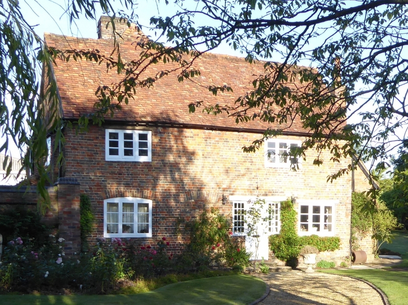
5125 CHALGRAVE TEBWORTH ROAD
(north side)
Wingfield
Pond Farmhouse
SF 9926 15/73
II
2.
South elevation first floor panel with raised letters CSA and date 1699. Chequered
brick. Two storeys. Old clay tile roof. L plan, East wing has exposed timber-framing
to north gable end. Brick band between floors. All modern casements.
Listing NGR: SP9996526220
External links are from the relevant listing authority and, where applicable, Wikidata. Wikidata IDs may be related buildings as well as this specific building. If you want to add or update a link, you will need to do so by editing the Wikidata entry.


Other nearby listed buildings
