Approximate Location Map
Large Map »
Latitude: 51.8799 / 51°52'47"N
Longitude: -0.5624 / 0°33'44"W
OS Eastings: 499054
OS Northings: 221128
OS Grid: SP990211
Mapcode National: GBR F3T.2N9
Mapcode Global: VHFRK.60KN
Plus Code: 9C3XVCHQ+X3
Entry Name: Lockington Farmhouse
Listing Date: 26 September 1980
Grade: II
Source: Historic England
Source ID: 1114770
English Heritage Legacy ID: 36171
ID on this website: 101114770
Location: Totternhoe, Central Bedfordshire, LU6
County: Central Bedfordshire
Civil Parish: Totternhoe
Built-Up Area: Totternhoe
Traditional County: Bedfordshire
Lieutenancy Area (Ceremonial County): Bedfordshire
Church of England Parish: Totternhoe
Church of England Diocese: St.Albans
Tagged with: Farmhouse Thatched farmhouse
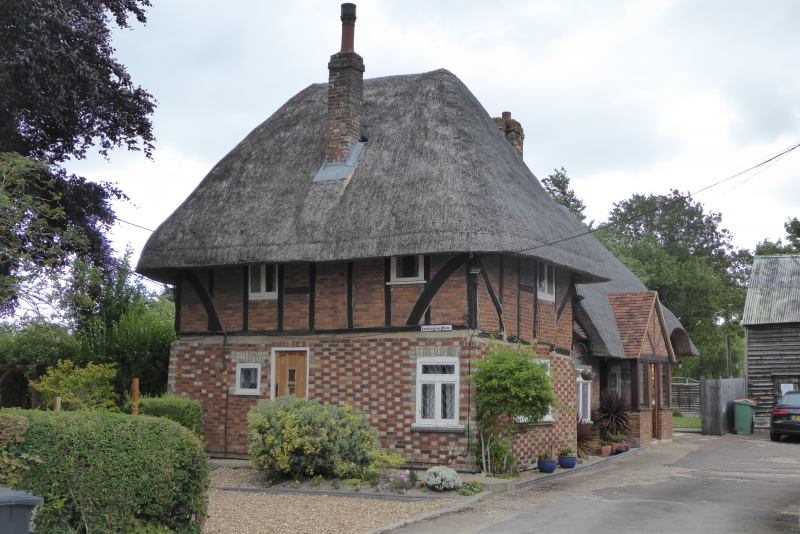
1.
5125 TOTTERNHOE CHURCH ROAD
(south-east side)
Church End
Lockington Farmhouse
SP 9921 33/389
II
2.
C17. Red and yellow chequered brick ground floor, timber-framed first floor
with red brick nogging. Two storeys. Thatched roof. Two lattice casements.
Back wing of one storey and attics with 2 windows.
Listing NGR: SP9901821045
External links are from the relevant listing authority and, where applicable, Wikidata. Wikidata IDs may be related buildings as well as this specific building. If you want to add or update a link, you will need to do so by editing the Wikidata entry.


Other nearby listed buildings
