Approximate Location Map
Large Map »
Latitude: 52.2059 / 52°12'21"N
Longitude: 0.1164 / 0°6'58"E
OS Eastings: 544715
OS Northings: 258514
OS Grid: TL447585
Mapcode National: GBR L79.L86
Mapcode Global: VHHK2.YTWC
Plus Code: 9F426448+8H
Entry Name: Gonville and Caius College, Wall of Master's Garden Fronting Trinity Hall Lane
Listing Date: 2 November 1972
Grade: II
Source: Historic England
Source ID: 1115153
English Heritage Legacy ID: 47151
ID on this website: 101115153
Location: Cambridge, Cambridgeshire, CB2
County: Cambridgeshire
District: Cambridge
Electoral Ward/Division: Castle
Parish: Non Civil Parish
Built-Up Area: Cambridge
Traditional County: Cambridgeshire
Lieutenancy Area (Ceremonial County): Cambridgeshire
Church of England Parish: Cambridge St Mary the Great with St Michael
Church of England Diocese: Ely
Tagged with: Building
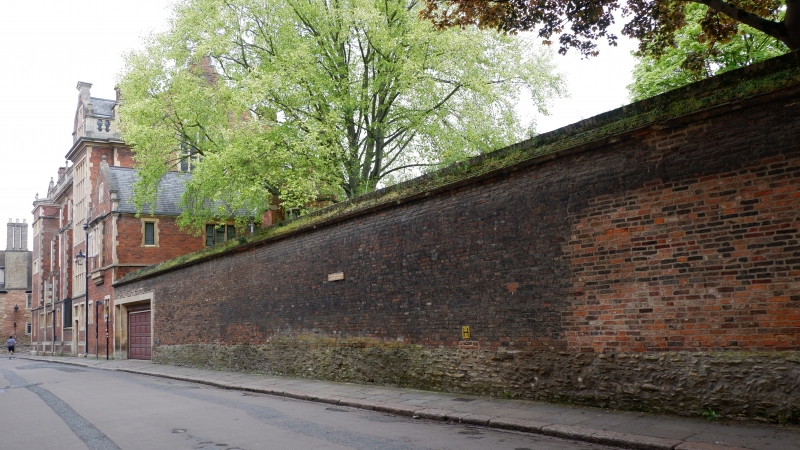
GONVILLE AND CAIUS COLLEGE
1.
942
Wall of Master's Garden
fronting Trinity Hall Lane
TL 4458 NE 3/338
II
2.
Cl4 rubble topped by C16 and later red brick. (RCHM).
Listing NGR: TL4471558514
External links are from the relevant listing authority and, where applicable, Wikidata. Wikidata IDs may be related buildings as well as this specific building. If you want to add or update a link, you will need to do so by editing the Wikidata entry.


Other nearby listed buildings
