Latitude: 51.5082 / 51°30'29"N
Longitude: -2.504 / 2°30'14"W
OS Eastings: 365118
OS Northings: 178928
OS Grid: ST651789
Mapcode National: GBR JV.J8VF
Mapcode Global: VH88H.KC35
Plus Code: 9C3VGF5W+7C
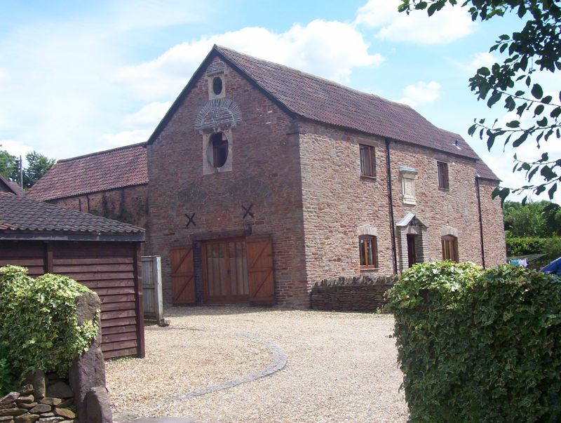
Entry Name: L-Shaped Range of Barn, Cowshed and Stores at Moorend Farm
Listing Date: 15 July 1981
Grade: II
Source: Historic England
Source ID: 1116187
English Heritage Legacy ID: 28793
ID on this website: 101116187
Location: Moorend, South Gloucestershire, BS16
County: South Gloucestershire
Civil Parish: Winterbourne
Built-Up Area: Whiteshill
Traditional County: Gloucestershire
Lieutenancy Area (Ceremonial County): Gloucestershire
Church of England Parish: Winterbourne Down
Church of England Diocese: Bristol
Tagged with: Building
1. 5118 EX-MANGOTSFIELD UD MOOREND ROAD Moorend L-shaped range of barn, cowshed and stores at Moorend Farm ST 67 NE 2/192 II 2. Dated 1701, later alterations. 'L'-shaped structure, partly rebuilt (formerly gable fronted) with eastern wing forming barn. Pennant stone rubble, pantile roofs with eaves and end gables. West elevation has central square-headed door opening with free stone open pediment and oval free stone tablet above enclosed in moulded square frame with cornice. Raised lettering on tablet: "BBE 1701" (or BRE). Cambered-headed window opening to right of door. Right hand end elevation has two 2-light casements with moulded stone mullions and dripmoulds, small oval window in gable face, relieving arches over. Similar oval window in gable face of left hand end elevation and below it a large oval window with 4 keys, set in oval frame with carved rosette in each spandrel. Later wide door opening to ground floor with double relieving arches over. South elevation of barn has hipped roof porch with double doors under square head, similar opening without midstrey to rear. Single loop openings front and rear and oval window with 4 keys in end elevation.
Listing NGR: ST6511878928
External links are from the relevant listing authority and, where applicable, Wikidata. Wikidata IDs may be related buildings as well as this specific building. If you want to add or update a link, you will need to do so by editing the Wikidata entry.


Other nearby listed buildings