Latitude: 51.2894 / 51°17'21"N
Longitude: 0.586 / 0°35'9"E
OS Eastings: 580418
OS Northings: 157649
OS Grid: TQ804576
Mapcode National: GBR PR3.4Z5
Mapcode Global: VHJM8.3VNF
Plus Code: 9F327HQP+QC
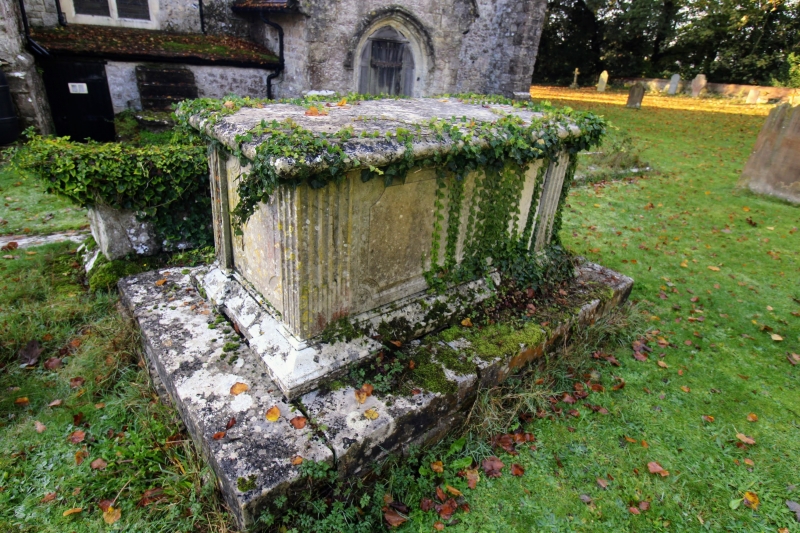
Entry Name: Table Tomb to Watts Family Circa 3 Yards North of Chancel of Church of St Mary the Virgin
Listing Date: 20 July 1984
Grade: II
Source: Historic England
Source ID: 1116325
English Heritage Legacy ID: 173716
ID on this website: 101116325
Location: St Mary's Church, Thurnham, Maidstone, Kent, ME14
County: Kent
District: Maidstone
Civil Parish: Thurnham
Traditional County: Kent
Lieutenancy Area (Ceremonial County): Kent
Tagged with: Table tomb Table tomb
TQ 85 NW THURNHAM THURNHAM LANE (west side)
6/209 Table tomb to Watts family circa 3 yards north of chancel of church of St. Mary the Virgin
GV II
Table tomb. Early C18. Stone on stone base with heavily chamfered plinth and lid. Decorative recessed end panels. West end to Catherine Watts, d. 1723
Listing NGR: TQ8023257319
External links are from the relevant listing authority and, where applicable, Wikidata. Wikidata IDs may be related buildings as well as this specific building. If you want to add or update a link, you will need to do so by editing the Wikidata entry.


Other nearby listed buildings