Latitude: 51.4957 / 51°29'44"N
Longitude: -0.1199 / 0°7'11"W
OS Eastings: 530607
OS Northings: 179093
OS Grid: TQ306790
Mapcode National: GBR KL.70
Mapcode Global: VHGQZ.VNYR
Plus Code: 9C3XFVWJ+72
Entry Name: Lambeth Palace
Listing Date: 19 October 1951
Grade: I
Source: Historic England
Source ID: 1116399
English Heritage Legacy ID: 204400
ID on this website: 101116399
Location: Lambeth, London, SE1
County: London
District: Lambeth
Electoral Ward/Division: Bishop's
Parish: Non Civil Parish
Built-Up Area: Lambeth
Traditional County: Surrey
Lieutenancy Area (Ceremonial County): Greater London
Church of England Parish: North Lambeth
Church of England Diocese: Southwark
LAMBETH PALACE ROAD SE1 1. (east side) 5023 Lambeth Palace TQ 3079 2/585 19.10.51
I
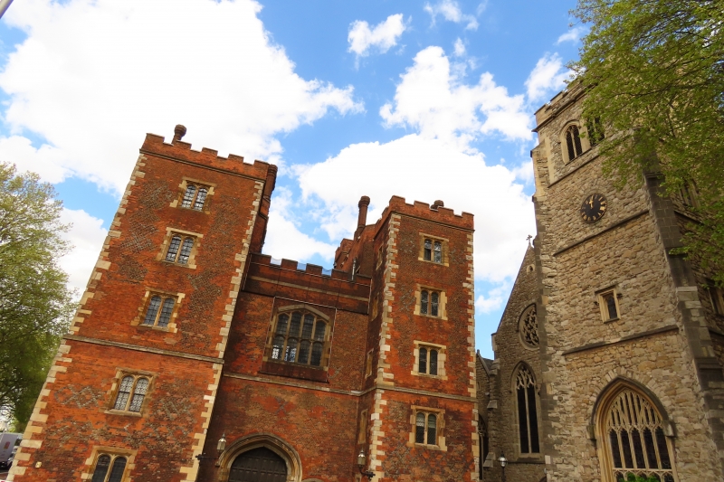
2. Group of ecclesiastical, ceremonial, defensive and residential: buildings of varying periods. At north-west corner the Water or Lollards' Tower 1435, of Kentish Rag with ashlar quoins and a brick turret; the C17 Land's Tower added in similar material (but with some flint) to the south. East of this the C13 chapel, Reigate stone with Purbeck dressings, and its earlier C15 crypt with some original plaster. To the east, the residential apartments of circa 1835 in collegiate gothic style. South-west of these the guardroom, a circa 1835 rebuilding of a C14 building which retains much original woodwork in the roof. West of this the courtyard, and south of the courtyard the Great Hall (now library) 1660-63, a building of mixed styles whose baroque elevations of red brick and Portland stone frame late-gothic windows and whose hammer beam roof uses entirely classical decoration. To the south-west, Morton's Gatehouse and tower of circa 1490. Red brick with blue diapering and stone dressings. Good interior woodwork including a panelled room covered with C17 wall paintings.
Listing NGR: TQ3059479049


Other nearby listed buildings