Approximate Location Map
Large Map »
Latitude: 52.7605 / 52°45'37"N
Longitude: -2.1804 / 2°10'49"W
OS Eastings: 387924
OS Northings: 318110
OS Grid: SJ879181
Mapcode National: GBR 177.TVN
Mapcode Global: WHBDZ.GWY4
Plus Code: 9C4VQR69+5V
Entry Name: Church Farmhouse
Listing Date: 10 January 1972
Grade: II
Source: Historic England
Source ID: 1116740
English Heritage Legacy ID: 442780
ID on this website: 101116740
Location: Bradley, Stafford, Staffordshire, ST18
County: Staffordshire
District: Stafford
Civil Parish: Bradley
Built-Up Area: Bradley
Traditional County: Staffordshire
Lieutenancy Area (Ceremonial County): Staffordshire
Church of England Parish: Bradeley St Mary and All Saints
Church of England Diocese: Lichfield
Tagged with: Farmhouse
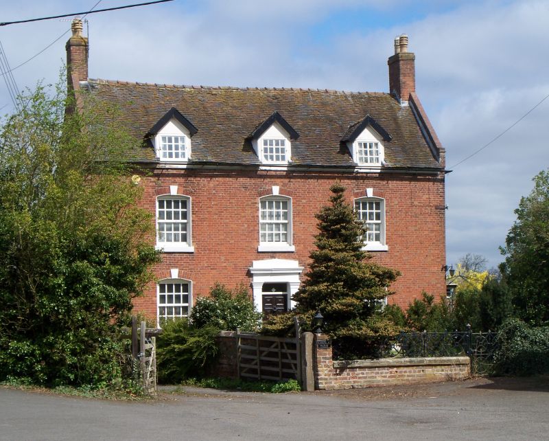
1.
2585 BRADLEY
Church Farmhouse
SJ 81 NE 9/10
II
2.
Late C18. Red brick; 2 storeys and attic; 3 sash windows in lined
reveals with keyblocks; pilaster doorcase with moulded cornice, plain
entablature and rectangular fanlight; plain eaves; parapeted gables at
ends and end brick stacks; 3 gabled dormers; tiled roof.
Listing NGR: SJ8792418110
External links are from the relevant listing authority and, where applicable, Wikidata. Wikidata IDs may be related buildings as well as this specific building. If you want to add or update a link, you will need to do so by editing the Wikidata entry.


Other nearby listed buildings
