Latitude: 51.422 / 51°25'19"N
Longitude: -2.4588 / 2°27'31"W
OS Eastings: 368196
OS Northings: 169323
OS Grid: ST681693
Mapcode National: GBR JX.PN6Z
Mapcode Global: VH88X.BJH7
Plus Code: 9C3VCGCR+RF
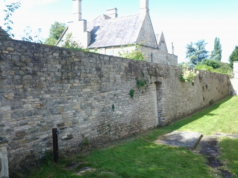
Entry Name: Boundary Wall Running Between the Parish Church of St Mary and the Grange, and Turning South West for Approx 95 Yards Along Road Frontage to the Dower House
Listing Date: 15 July 1981
Grade: II
Source: Historic England
Source ID: 1116811
English Heritage Legacy ID: 28553
ID on this website: 101116811
Location: St Mary's Church, Bitton, South Gloucestershire, BS30
County: South Gloucestershire
Civil Parish: Bitton
Built-Up Area: Bitton
Traditional County: Gloucestershire
Lieutenancy Area (Ceremonial County): Gloucestershire
Church of England Parish: Warmley Syston and Bitton
Church of England Diocese: Bristol
Tagged with: Wall
1. 5118 BITTON CHURCH ROAD (east side) Boundary wall running between the Parish Church of St Mary and the Grange, and turning south-west for approximately 95 yds along road frontage to The Dower House ST 6869 15/123 II GV 2. Possibly of mediaeval origin. Restored C18 and C19. Separates churchyard from the Grange and associated buildings. Rubble, between 9 and 12 ft high, one section on south-west reduced to 7 ft. The main section has a set back about 25 yds from west end. Returned at east end to enclose garden of the Dower House to the east (about 130 yds). Opposite first bay of the chancel is a doorway with square head and late C17 mouldings. To east of this on south side is a late C19 segment headed summer canopy with cast-iron scrollwork.
Listing NGR: ST6826069319
External links are from the relevant listing authority and, where applicable, Wikidata. Wikidata IDs may be related buildings as well as this specific building. If you want to add or update a link, you will need to do so by editing the Wikidata entry.


Other nearby listed buildings