Approximate Location Map
Large Map »
Latitude: 52.0304 / 52°1'49"N
Longitude: -2.1204 / 2°7'13"W
OS Eastings: 391833
OS Northings: 236894
OS Grid: SO918368
Mapcode National: GBR 1J6.QQF
Mapcode Global: VH93N.67CB
Plus Code: 9C4V2VJH+5R
Entry Name: Manor Farmhouse
Listing Date: 11 February 1965
Grade: II
Source: Historic England
Source ID: 1117056
English Heritage Legacy ID: 442264
ID on this website: 101117056
Location: Bredon, Wychavon, Worcestershire, GL20
County: Worcestershire
District: Wychavon
Civil Parish: Bredon
Built-Up Area: Bredon
Traditional County: Worcestershire
Lieutenancy Area (Ceremonial County): Worcestershire
Church of England Parish: Bredon
Church of England Diocese: Worcester
Tagged with: Farmhouse
BREDON EREDON
1.
2301
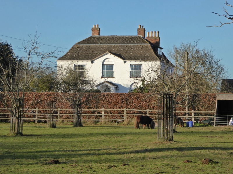
Manor Farmhouse
SO 93 NW 17/89 11.2.65.
II
2.
C18/19 square painted brick house with hipped mansard slate roof and small
pediment at front. 2-storeys. 3 light windows with semi-circular headed
recesses over. Pedimented brick porch.
Listing NGR: SO9183236895
External links are from the relevant listing authority and, where applicable, Wikidata. Wikidata IDs may be related buildings as well as this specific building. If you want to add or update a link, you will need to do so by editing the Wikidata entry.


Other nearby listed buildings
