Approximate Location Map
Large Map »
Latitude: 52.0298 / 52°1'47"N
Longitude: -2.1187 / 2°7'7"W
OS Eastings: 391950
OS Northings: 236827
OS Grid: SO919368
Mapcode National: GBR 1J6.R53
Mapcode Global: VH93N.778S
Plus Code: 9C4V2VHJ+WG
Entry Name: Obelisk
Listing Date: 11 February 1965
Grade: II
Source: Historic England
Source ID: 1319647
English Heritage Legacy ID: 442286
ID on this website: 101319647
Location: Bredon, Wychavon, Worcestershire, GL20
County: Worcestershire
District: Wychavon
Civil Parish: Bredon
Built-Up Area: Bredon
Traditional County: Worcestershire
Lieutenancy Area (Ceremonial County): Worcestershire
Church of England Parish: Bredon
Church of England Diocese: Worcester
Tagged with: Obelisk
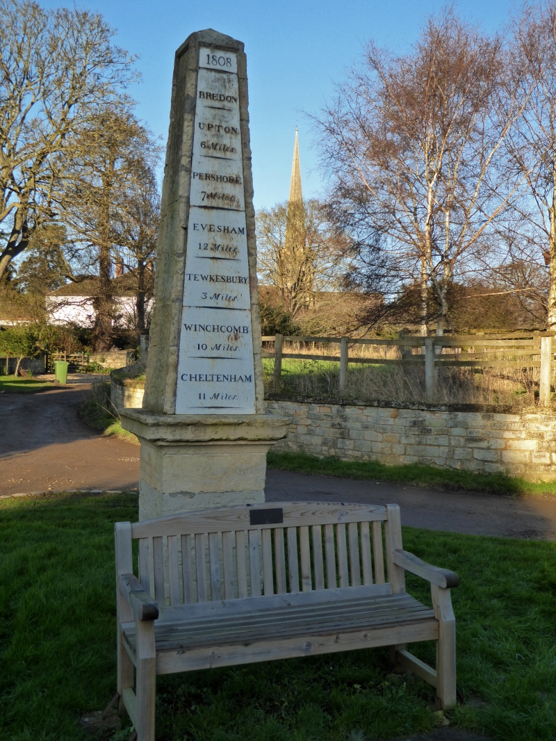
BREDON BREDON
1.
2301 Tewkesbury Road
Obelisk
SO 93 NW 17/111 11.2.65.
II
2.
1808. Tapering 4 sided stone obelisk on pedestal with moulded cornice.
One side inscribed as direction post giving distances to nearby towns.
Listing NGR: SO9194936827
External links are from the relevant listing authority and, where applicable, Wikidata. Wikidata IDs may be related buildings as well as this specific building. If you want to add or update a link, you will need to do so by editing the Wikidata entry.


Other nearby listed buildings
