Latitude: 51.3806 / 51°22'50"N
Longitude: -1.1536 / 1°9'12"W
OS Eastings: 459002
OS Northings: 164961
OS Grid: SU590649
Mapcode National: GBR 93Q.95F
Mapcode Global: VHCZM.YKHG
Plus Code: 9C3W9RJW+7H
Entry Name: Forster's Farmhouse
Listing Date: 10 November 1983
Grade: II
Source: Historic England
Source ID: 1117345
English Heritage Legacy ID: 39489
ID on this website: 101117345
Location: Aldermaston, West Berkshire, RG7
County: West Berkshire
Civil Parish: Aldermaston
Traditional County: Berkshire
Lieutenancy Area (Ceremonial County): Berkshire
Church of England Parish: Aldermaston
Church of England Diocese: Oxford
Tagged with: Farmhouse
ALDERMASTON A340 (west side)
SU 56 SE
6/18 Forster's Farmhouse
GV II
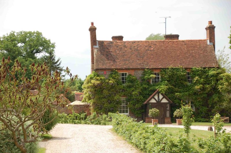
Farmhouse. Late C18. Grey brick headers with red dressings, plinth, plat band
and dentil brick eaves cornice to old tile roof with end stacks. 2 storeys:
3 bays, glazing bar sashes. Central half glazed door with rectangular fanlight,
and C19 gabled porch with C20 door.
Listing NGR: SU5903664945
External links are from the relevant listing authority and, where applicable, Wikidata. Wikidata IDs may be related buildings as well as this specific building. If you want to add or update a link, you will need to do so by editing the Wikidata entry.


Other nearby listed buildings