Latitude: 51.4738 / 51°28'25"N
Longitude: -0.9131 / 0°54'47"W
OS Eastings: 475582
OS Northings: 175544
OS Grid: SU755755
Mapcode National: GBR C5J.HYD
Mapcode Global: VHDWV.4730
Plus Code: 9C3XF3FP+GP
Entry Name: Wall Between Site of Former Palace of Bishops of Salisbury and Churchyard
Listing Date: 26 January 1967
Grade: II
Source: Historic England
Source ID: 1117437
English Heritage Legacy ID: 41209
ID on this website: 101117437
Location: St Andrew's Church, Sonning, Wokingham, Berkshire, RG4
County: Wokingham
Civil Parish: Sonning
Built-Up Area: Woodley
Traditional County: Berkshire
Lieutenancy Area (Ceremonial County): Berkshire
Church of England Parish: Sonning
Church of England Diocese: Oxford
Tagged with: Wall
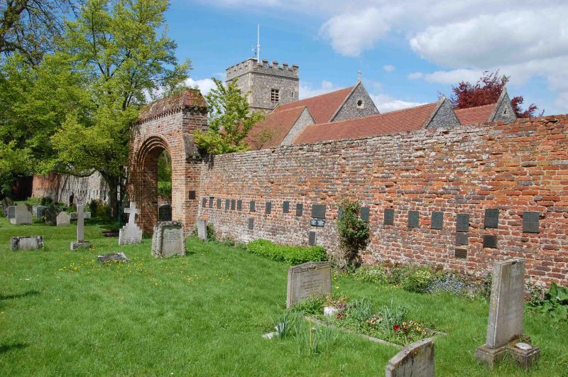
SU 7575 SONNING
14/44 Wall Between Site
26.1.67 Of Former Palace
Of Bishops Of
Salisbury And
Churchyard
GV II
Hall. Brick, part C16 brickwork, deep weathered coping on dentil string.
New large central brick arched opening added 1948.
Listing NGR: SU7558275544
External links are from the relevant listing authority and, where applicable, Wikidata. Wikidata IDs may be related buildings as well as this specific building. If you want to add or update a link, you will need to do so by editing the Wikidata entry.


Other nearby listed buildings