Approximate Location Map
Large Map »
Latitude: 51.3688 / 51°22'7"N
Longitude: -0.9662 / 0°57'58"W
OS Eastings: 472060
OS Northings: 163816
OS Grid: SU720638
Mapcode National: GBR C6T.2K4
Mapcode Global: VHDX6.6VKJ
Plus Code: 9C3X929M+GG
Entry Name: Milestone
Listing Date: 14 February 1986
Grade: II
Source: Historic England
Source ID: 1118097
English Heritage Legacy ID: 41567
ID on this website: 101118097
Location: Riseley, Wokingham, Berkshire, RG7
County: Wokingham
Civil Parish: Swallowfield
Built-Up Area: Swallowfield
Traditional County: Berkshire
Lieutenancy Area (Ceremonial County): Berkshire
Church of England Parish: Swallowfield
Church of England Diocese: Oxford
Tagged with: Milestone
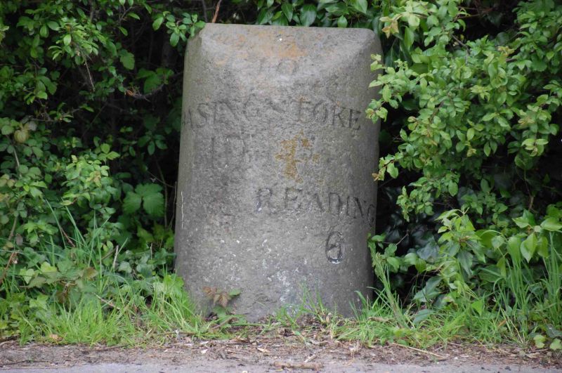
SWALLOWFIELD BASINGSTOKE ROAD
SU 76 SW
(East side)
11/3 Milestone
II
Milestone. Early C19 stone, D-plan with incised Roman letters on semi-
circular front which read Reading 6
Basingstoke 10
Listing NGR: SU7206063816
External links are from the relevant listing authority and, where applicable, Wikidata. Wikidata IDs may be related buildings as well as this specific building. If you want to add or update a link, you will need to do so by editing the Wikidata entry.


Other nearby listed buildings
