Approximate Location Map
Large Map »
Latitude: 51.551 / 51°33'3"N
Longitude: -0.8907 / 0°53'26"W
OS Eastings: 477011
OS Northings: 184155
OS Grid: SU770841
Mapcode National: GBR C4L.PMB
Mapcode Global: VHDWG.H8ZT
Plus Code: 9C3XH425+CP
Entry Name: Remenham Farmhouse
Listing Date: 23 December 1983
Grade: II
Source: Historic England
Source ID: 1118190
English Heritage Legacy ID: 41277
ID on this website: 101118190
Location: Remenham, Wokingham, Berkshire, RG9
County: Wokingham
Civil Parish: Remenham
Traditional County: Berkshire
Lieutenancy Area (Ceremonial County): Berkshire
Church of England Parish: Remenham
Church of England Diocese: Oxford
Tagged with: Farmhouse
REMENHAM REMENHAM VILLAGE
SU 78 E
1/4
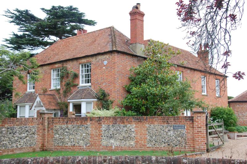
Remenham Farmhouse
G.V. II
Farmhouse. Late C18 altered, brick, hipped old tile roof, 2 storeys.
East front : 3 bays sash windows with glazing bars, two C19 angular
bays on ground floor flanking a C19 gabled wood porch.
Listing NGR: SU7701184155
External links are from the relevant listing authority and, where applicable, Wikidata. Wikidata IDs may be related buildings as well as this specific building. If you want to add or update a link, you will need to do so by editing the Wikidata entry.


Other nearby listed buildings
