Approximate Location Map
Large Map »
Latitude: 51.7683 / 51°46'6"N
Longitude: -0.927 / 0°55'37"W
OS Eastings: 474140
OS Northings: 208285
OS Grid: SP741082
Mapcode National: GBR C21.0GR
Mapcode Global: VHDV8.WT98
Plus Code: 9C3XQ39F+86
Entry Name: 19, Churchway
Listing Date: 11 October 1985
Grade: II
Source: Historic England
Source ID: 1118291
English Heritage Legacy ID: 43140
ID on this website: 101118291
Location: Church End, Buckinghamshire, HP17
County: Buckinghamshire
Civil Parish: Haddenham
Built-Up Area: Haddenham
Traditional County: Buckinghamshire
Lieutenancy Area (Ceremonial County): Buckinghamshire
Church of England Parish: Haddenham
Church of England Diocese: Oxford
Tagged with: Building
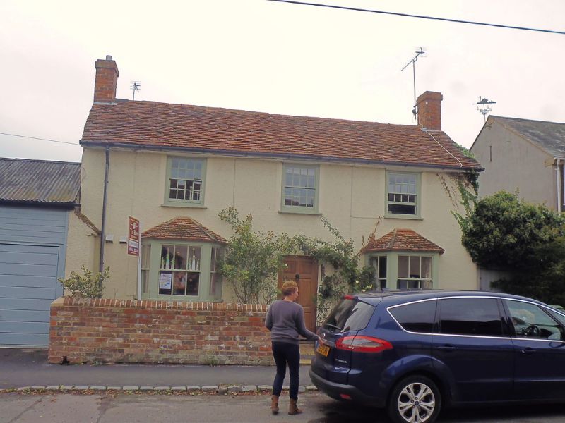
SP 7408 HADDENHAM CHURCHWAY
(west side)
11/199 No.19
-
GV II
House. Early C19. Witchert, colourwashed and rendered. Old tile roof.
3 bays and 2 storeys. Central 6 flush panel door. Canted hipped tiled
roof bay windows to outer bays with sash windows. Sash windows to
first floor. Gable stacks. Shorter parallel roofed rear range.
Listed for group value.
Listing NGR: SP7414008285
External links are from the relevant listing authority and, where applicable, Wikidata. Wikidata IDs may be related buildings as well as this specific building. If you want to add or update a link, you will need to do so by editing the Wikidata entry.


Other nearby listed buildings
