Latitude: 50.6852 / 50°41'6"N
Longitude: -2.1131 / 2°6'47"W
OS Eastings: 392103
OS Northings: 87294
OS Grid: SY921872
Mapcode National: GBR 32T.SPN
Mapcode Global: FRA 67G8.GKM
Plus Code: 9C2VMVPP+3P
Entry Name: 50 and 52, West Street
Listing Date: 7 May 1952
Grade: II
Source: Historic England
Source ID: 1119951
English Heritage Legacy ID: 108123
ID on this website: 101119951
Location: Wareham, Dorset, BH20
County: Dorset
Civil Parish: Wareham Town
Built-Up Area: Wareham
Traditional County: Dorset
Lieutenancy Area (Ceremonial County): Dorset
Church of England Parish: Wareham Lady St Mary
Church of England Diocese: Salisbury
Tagged with: Building
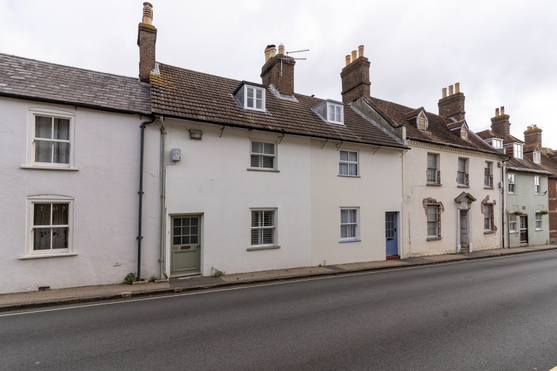
1.
5190 WEST STREET
(North Side)
Nos 50 & 52
SY 9287 1/92 7.5.52.
II GV
2.
C18. Stucco. Pitched pantile roof with overhanging eaves. Red brick stacks.
2 storeys and attics. 2 ranges of cased sashes. 1 modern door and 1 door with
4 moulded panels. 2 flat-topped attic dormers with casements.
Nos 46 to 56 (even) form a group.
Listing NGR: SY9210387294
External links are from the relevant listing authority and, where applicable, Wikidata. Wikidata IDs may be related buildings as well as this specific building. If you want to add or update a link, you will need to do so by editing the Wikidata entry.


Other nearby listed buildings