Latitude: 50.6849 / 50°41'5"N
Longitude: -2.1132 / 2°6'47"W
OS Eastings: 392097
OS Northings: 87255
OS Grid: SY920872
Mapcode National: GBR 32T.SNH
Mapcode Global: FRA 67G8.GJP
Plus Code: 9C2VMVMP+XP
Entry Name: The Town Pound
Listing Date: 25 September 1990
Grade: II
Source: Historic England
Source ID: 1249347
English Heritage Legacy ID: 108127
ID on this website: 101249347
Location: Wareham, Dorset, BH20
County: Dorset
Civil Parish: Wareham Town
Built-Up Area: Wareham
Traditional County: Dorset
Lieutenancy Area (Ceremonial County): Dorset
Church of England Parish: Wareham Lady St Mary
Church of England Diocese: Salisbury
Tagged with: Architectural structure
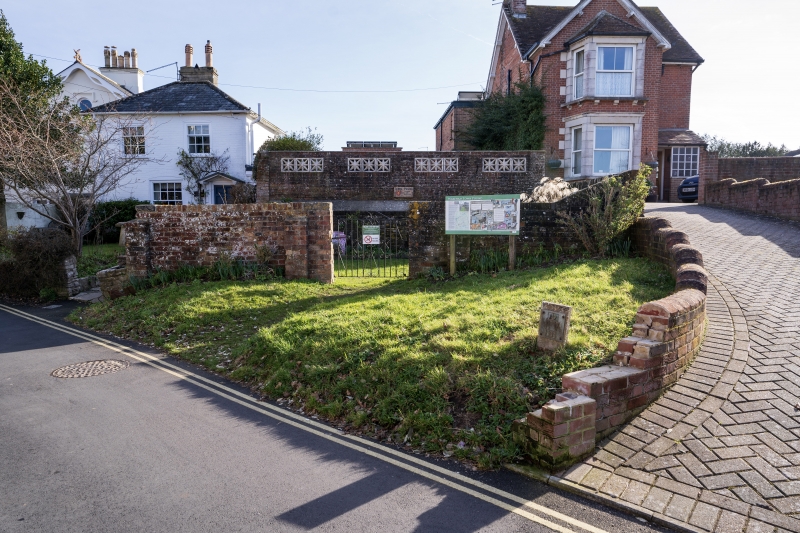
SY 9287 WAREHAM POUND LANE
1/217 The Town Pound
GV II
Pound. C18 with later repairs. Brick with brick-on-edge coping. Square plan.
Entrance to north-west wall. Built to hold stray and impounded animals from the
town's common.
Listing NGR: SY9209787255
External links are from the relevant listing authority and, where applicable, Wikidata. Wikidata IDs may be related buildings as well as this specific building. If you want to add or update a link, you will need to do so by editing the Wikidata entry.


Other nearby listed buildings