Latitude: 54.511 / 54°30'39"N
Longitude: -2.0513 / 2°3'4"W
OS Eastings: 396774
OS Northings: 512857
OS Grid: NY967128
Mapcode National: GBR GJ38.PP
Mapcode Global: WHB4J.GWD5
Plus Code: 9C6VGW6X+CF
Entry Name: Bridge, 220 Metres North of East Mellwaters Farmhouse
Listing Date: 17 June 1986
Grade: II
Source: Historic England
Source ID: 1121067
English Heritage Legacy ID: 111163
ID on this website: 101121067
Location: County Durham, DL12
County: County Durham
Civil Parish: Bowes
Traditional County: Yorkshire
Lieutenancy Area (Ceremonial County): County Durham
Tagged with: Bridge
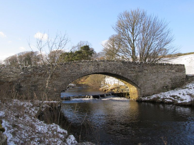
BOWES A66
NY 91 SE 967128
(South side,off)
19/6 Bridge, 220 metres
north of East
Mellwaters Farmhouse
II
Road bridge. Probably mid C18; rebuilt parapet. Coursed rubble with dressed
stone arch.
Both faces similar. Segmental arch, with flush voussoirs, rests on a tall
plinth of squared stones. Rising curved parapet with roughly-shaped, upright
coping stones; splayed ends.
Listing NGR: NY9677412857
External links are from the relevant listing authority and, where applicable, Wikidata. Wikidata IDs may be related buildings as well as this specific building. If you want to add or update a link, you will need to do so by editing the Wikidata entry.


Other nearby listed buildings