Latitude: 54.5083 / 54°30'29"N
Longitude: -2.0676 / 2°4'3"W
OS Eastings: 395720
OS Northings: 512557
OS Grid: NY957125
Mapcode National: GBR GJ09.5N
Mapcode Global: WHB4J.6YP7
Plus Code: 9C6VGW5J+8X
Entry Name: Limekiln 60 Metres South of God's Bridge Cottage
Listing Date: 7 November 1990
Grade: II
Source: Historic England
Source ID: 1121825
English Heritage Legacy ID: 111365
ID on this website: 101121825
Location: County Durham, DL12
County: County Durham
Civil Parish: Bowes
Traditional County: Yorkshire
Lieutenancy Area (Ceremonial County): County Durham
Tagged with: Lime kiln
The following building shall be added
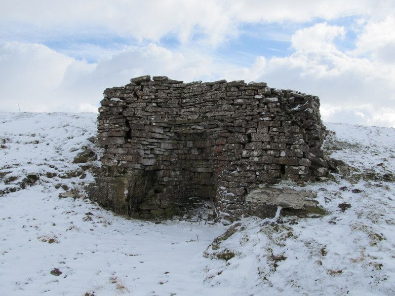
Bowes A66 NY 91 SE 19/188 (South side off) Limekiln: 60 metres south of God's Bridge Cottage II Disused Limekiln. Early C19. Squared rubble.
Large single opening slopes battered front and sides partly built into the hillside. Flat topped opening slopes into curved back wall. Ruinous top.
Listing NGR: NY9572012557
External links are from the relevant listing authority and, where applicable, Wikidata. Wikidata IDs may be related buildings as well as this specific building. If you want to add or update a link, you will need to do so by editing the Wikidata entry.


Other nearby listed buildings