Latitude: 54.7724 / 54°46'20"N
Longitude: -1.5798 / 1°34'47"W
OS Eastings: 427127
OS Northings: 542028
OS Grid: NZ271420
Mapcode National: GBR KFD8.R0
Mapcode Global: WHC4Q.P9WQ
Plus Code: 9C6WQCCC+X3
Entry Name: Mill House, Footbridge and Wall Adjoining
Listing Date: 10 March 1988
Grade: II
Source: Historic England
Source ID: 1121343
English Heritage Legacy ID: 110519
ID on this website: 101121343
Location: Durham, County Durham, DH1
County: County Durham
Electoral Ward/Division: Elvet and Gilesgate
Parish: City of Durham
Built-Up Area: Durham
Traditional County: Durham
Lieutenancy Area (Ceremonial County): County Durham
Church of England Parish: Durham St Margaret of Antioch
Church of England Diocese: Durham
Tagged with: Footbridge
DURHAM AND FRAMWELLGATE SOUTH STREET BANKS NZ 2742 SE (Right bank of River Wear)
14/461 Mill House, footbridge and wall adjoining
GV II
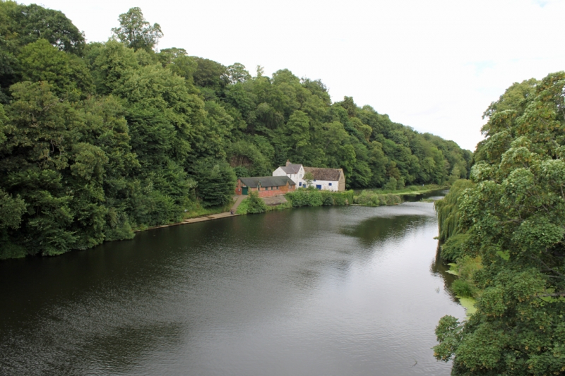
Water mill. Probably C18 incorporating earlier buildings. Sandstone rubble with quoins. Roof Welsh slate and moss-covered flat concrete tiles, with brick chimneys. L-plan. North elevation: 3 storeys, 3 bays at left and 2 storeys, 2 bays at right on higher ground; irregular fenestration. 3-storey part has 2-panelled door in right bay under wood lintel with wood jambs; 2-storey part has boarded door in centre under stone lintel. A variety of window shapes and sizes with wood or stone lintels. Low blocked opening at left has wood lintel. Roof has narrow gable to front at right end behind and above ridge. Brick chimneys on right return. Wide stone wall parallel to left return encloses mill race, and is joined to house by footbridge.
Listing NGR: NZ2712742028
External links are from the relevant listing authority and, where applicable, Wikidata. Wikidata IDs may be related buildings as well as this specific building. If you want to add or update a link, you will need to do so by editing the Wikidata entry.


Other nearby listed buildings