Latitude: 54.7732 / 54°46'23"N
Longitude: -1.5806 / 1°34'50"W
OS Eastings: 427077
OS Northings: 542115
OS Grid: NZ270421
Mapcode National: GBR KFD7.LQ
Mapcode Global: WHC4Q.P9J3
Plus Code: 9C6WQCF9+7Q
Entry Name: 35, SOUTH STREET (See details for further address information)
Listing Date: 19 February 1970
Last Amended: 30 April 1971
Grade: II
Source: Historic England
Source ID: 1161460
English Heritage Legacy ID: 110504
ID on this website: 101161460
Location: Durham, County Durham, DH1
County: County Durham
Electoral Ward/Division: Elvet and Gilesgate
Parish: City of Durham
Built-Up Area: Durham
Traditional County: Durham
Lieutenancy Area (Ceremonial County): County Durham
Church of England Parish: Durham St Margaret of Antioch
Church of England Diocese: Durham
Tagged with: Building
DURHAM AND FRAMWELLGATE SOUTH STREET NZ 2742 SE (West side)
14/446 Nos. 35 and 36 19/2/70 and 30/4/71 GV II
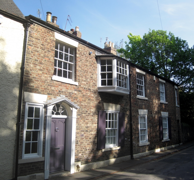
2 houses. Early C19. English garden wall bond brick (3 and one) with painted ashlar dressings and plinth; right return gable sandstone rubble; Welsh slate roof with brick chimneys. 2 storeys, 4 windows. No. 35 has 4-panelled door and fanlight with glazing bars, in open-pedimented doorcase with panelled pilasters, in first bay. No. 36 has 4-panelled door and overlight under wedge stone lintel in third bay. Similar lintels to sashes with glazing bars and to narrow sash at left of door of No. 35; large inserted oriel on first floor in second bay. Ground floor windows have external shutters. Boot-scraper recessed beside door of No. 35. Low-pitched roof has 3 ridge chimneys.
Listing NGR: NZ2707742115
External links are from the relevant listing authority and, where applicable, Wikidata. Wikidata IDs may be related buildings as well as this specific building. If you want to add or update a link, you will need to do so by editing the Wikidata entry.


Other nearby listed buildings