Approximate Location Map
Large Map »
Latitude: 54.776 / 54°46'33"N
Longitude: -1.5734 / 1°34'24"W
OS Eastings: 427536
OS Northings: 542424
OS Grid: NZ275424
Mapcode National: GBR KFG6.4Q
Mapcode Global: WHC4Q.S7X0
Plus Code: 9C6WQCGG+9J
Entry Name: Elvet Bridge
Listing Date: 6 May 1952
Grade: I
Source: Historic England
Source ID: 1121355
English Heritage Legacy ID: 110443
ID on this website: 101121355
Location: The Sands, County Durham, DH1
County: County Durham
Electoral Ward/Division: Elvet and Gilesgate
Parish: City of Durham
Built-Up Area: Durham
Traditional County: Durham
Lieutenancy Area (Ceremonial County): County Durham
Church of England Parish: Durham St Nicholas
Church of England Diocese: Durham
Tagged with: Bridge
DURHAM AND FRAMWELLGATE RIVER WEAR
NZ 2742 SE
15/388 Elvet Bridge
6/5/52
GV I
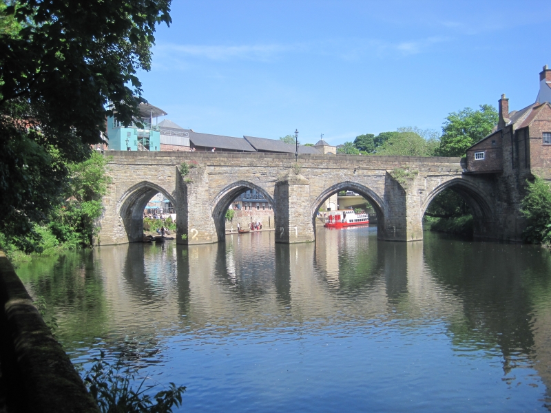
Bridge. Early C13 incorporating one arch of late C12 work. Central 3 arches
renewed after 1771 flood; north side (upstream) doubled in width in 1804-5.
Coursed squared sandstone with ashlar dressings. 7 river arches, 2 land arches
on west and one on east. East arch stepped southwards is round and chamfered;
other south arches are double-chamfered and 2-centred, with 5 ribs of which
the outer is chamfered; northern extension has cutwaters alternately sloping-
topped and hipped, flanking 2-centred arches. Hipped south cutwaters. Band at
road bed level; parapet with low rounded coping; stone steps alongside on north
side at west end. 2 west land arches are beneath present road; the easternmost
of them adapted as house of correction in 1632 has iron grilles over boarded
doors. South-east arch surpported medieval chapel of St. Andrew, of which part
may survive under No. 97 Elvet Bridge (q.v.).
A scheduled ancient monument.
Listing NGR: NZ2753642424
External links are from the relevant listing authority and, where applicable, Wikidata. Wikidata IDs may be related buildings as well as this specific building. If you want to add or update a link, you will need to do so by editing the Wikidata entry.


Other nearby listed buildings
