Latitude: 54.7763 / 54°46'34"N
Longitude: -1.5741 / 1°34'26"W
OS Eastings: 427496
OS Northings: 542457
OS Grid: NZ274424
Mapcode National: GBR KFG6.0M
Mapcode Global: WHC4Q.S6MR
Plus Code: 9C6WQCGG+G9
Entry Name: 18, Elvet Bridge
Listing Date: 30 April 1971
Grade: I
Source: Historic England
Source ID: 1323228
English Heritage Legacy ID: 110188
ID on this website: 101323228
Location: The Sands, County Durham, DH1
County: County Durham
Electoral Ward/Division: Elvet and Gilesgate
Parish: City of Durham
Built-Up Area: Durham
Traditional County: Durham
Lieutenancy Area (Ceremonial County): County Durham
Church of England Parish: Durham St Nicholas
Church of England Diocese: Durham
DURHAM AND FRAMWELLGATE ELVET BRIDGE NW2742SW and NZ2742SE (North side)
14/136 and 16/136 No. 18 30.4.71 GV I
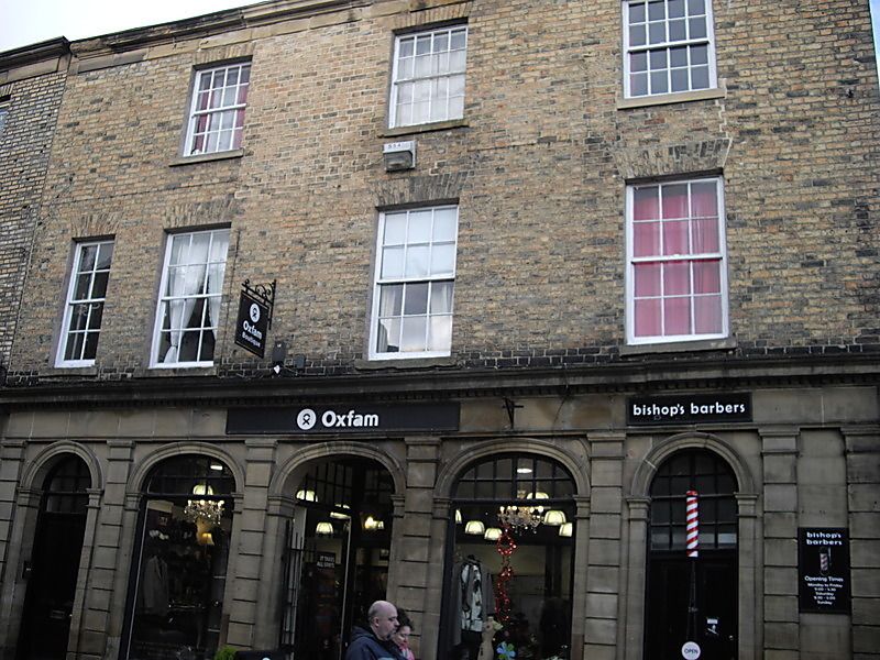
House now shop, incorporating House of Correction in cellar, which extends into land arch of Elvet Bridge. Bridge medieval, prison 1632, house and shop later C19. Coursed squared sandstone House of Correction; shop has ashlar ground floor with yellow Flemish bond brick and ashlar dressings above; Welsh slate roof. Elevation to street: 3 storeys, 4 bays, the left narrower. Arcaded ground floor has 3-panelled doors in end bays and recessed half-glazed central shop door; round or elliptical arches over windows and entrances have upper lights with glazing bars; bays are defined by Tuscan pilasters, paired at right end, under entablature with dentilled cornice. Sashes with glazing bars on upper floors have flat brick arches and projecting stone sills; top left window is blind. Stone eaves band and gutter cornice. Included for bridge and cells below. Interior of House of Correction has elliptical brick arch over wrought iron grille and heavy wood door.
Elvet Bridge Land arch has cells built into it, 2-centred arch with 5 flat ribs, extending under road surface.
Listing NGR: NZ2749642457
External links are from the relevant listing authority and, where applicable, Wikidata. Wikidata IDs may be related buildings as well as this specific building. If you want to add or update a link, you will need to do so by editing the Wikidata entry.


Other nearby listed buildings