Latitude: 54.5427 / 54°32'33"N
Longitude: -1.9274 / 1°55'38"W
OS Eastings: 404796
OS Northings: 516387
OS Grid: NZ047163
Mapcode National: GBR GHZX.JB
Mapcode Global: WHB4L.C2FT
Plus Code: 9C6WG3VF+33
Entry Name: Barnard Castle Bridge, over the River Tees
Listing Date: 12 January 1967
Grade: I
Source: Historic England
Source ID: 1121647
English Heritage Legacy ID: 111755
ID on this website: 101121647
Location: Startforth, County Durham, DL12
County: County Durham
Civil Parish: Startforth
Built-Up Area: Barnard Castle
Traditional County: Yorkshire
Lieutenancy Area (Ceremonial County): County Durham
Tagged with: Road bridge
NZ 0416 SE STARTFORTH BRIDGE END
11/164 Barnard Castle 12.1.67 Bridge, over the River Tees
GV I
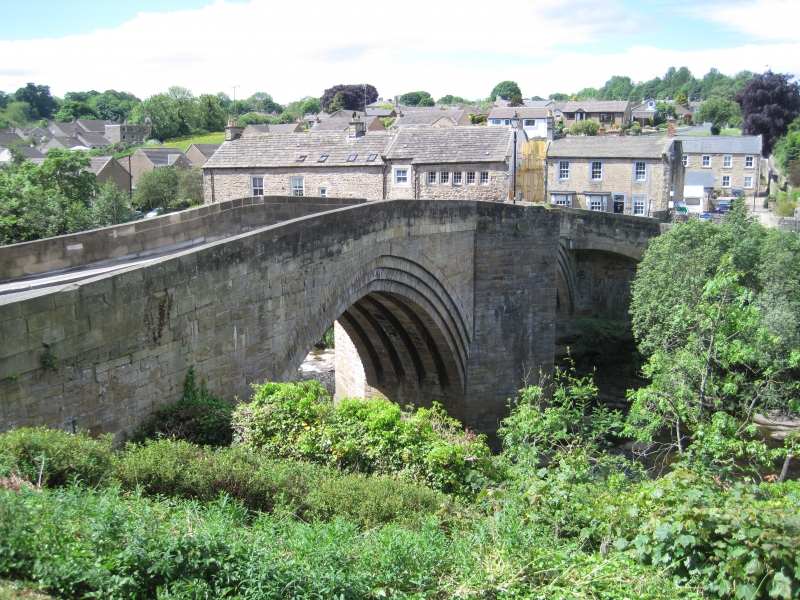
Road bridge, 1569 repaired 1771. Squared stone. Two segmental-pointed triple-stepped arches, the eastern slightly taller, each on 5 square ribs; triangular cutwaters between carried up as pedestrian refuges; later squinch arches carrying C20 widening of appoach road to south-east and north-west. C18 parapets with slightly-arched coping, stepped out from wall faces above the arches; on inner face of parapet in southern refuge are adjacent blocks with incised C.D. and brass-inset Y marking Durham/North Riding boundary. N R
Listing NGR: NZ0480116388
External links are from the relevant listing authority and, where applicable, Wikidata. Wikidata IDs may be related buildings as well as this specific building. If you want to add or update a link, you will need to do so by editing the Wikidata entry.


Other nearby listed buildings