Latitude: 54.5937 / 54°35'37"N
Longitude: -1.8013 / 1°48'4"W
OS Eastings: 412934
OS Northings: 522078
OS Grid: NZ129220
Mapcode National: GBR HHVB.T1
Mapcode Global: WHC5D.9SGR
Plus Code: 9C6WH5VX+FF
Entry Name: Dutch Barn c.300 metres north of stables and coach house
Listing Date: 14 September 1966
Grade: II*
Source: Historic England
Source ID: 1121777
English Heritage Legacy ID: 111453
ID on this website: 101121777
Location: Raby, County Durham, DL2
County: County Durham
Civil Parish: Raby with Keverstone
Traditional County: Durham
Lieutenancy Area (Ceremonial County): County Durham
Church of England Parish: Staindrop
Church of England Diocese: Durham
Tagged with: Barn
This list entry was subject to a Minor Amendment on 20 January 2025 to update details in the description and to reformat the text to current standards
NZ 1222
15/88
RABY WITH KEVERSTONE
RABY PARK
Dutch Barn c.300 metres north of stables and coach house
14.9.66
GV
II*
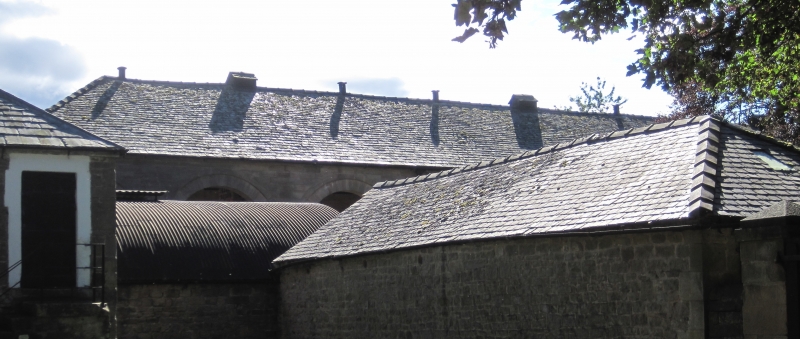
Dutch barn. Probably third quarter C18. Sandstone ashlar; graduated slate roof. One high storey, Ten bays. Recessed round-headed open-arcade on square piers with impost bands; two arches in returns on similar piers. Hipped roof.
Interior has three central brick piers with alternate headers-and-spaces, and narrow round arch at foot of each side, providing ventilation at heart of stack.
Listing NGR: NZ1293422078
External links are from the relevant listing authority and, where applicable, Wikidata. Wikidata IDs may be related buildings as well as this specific building. If you want to add or update a link, you will need to do so by editing the Wikidata entry.


Other nearby listed buildings