Latitude: 54.5937 / 54°35'37"N
Longitude: -1.8011 / 1°48'3"W
OS Eastings: 412951
OS Northings: 522072
OS Grid: NZ129220
Mapcode National: GBR HHVB.W2
Mapcode Global: WHC5D.9SLS
Plus Code: 9C6WH5VX+FH
Entry Name: Stable Block North-East of Stables and Coach-House
Listing Date: 14 September 1966
Last Amended: 30 September 1987
Grade: II
Source: Historic England
Source ID: 1310772
English Heritage Legacy ID: 111455
ID on this website: 101310772
Location: Raby, County Durham, DL2
County: County Durham
Civil Parish: Raby with Keverstone
Traditional County: Durham
Lieutenancy Area (Ceremonial County): County Durham
Church of England Parish: Staindrop
Church of England Diocese: Durham
Tagged with: Stable
RABY WITH KEVERSTONE RABY PARK NZ 1222 15/90 Stable block north- 14/9/66 east of stables and coach-house (formerly listed as building to rear of stables at present used as piggeries)
GV II
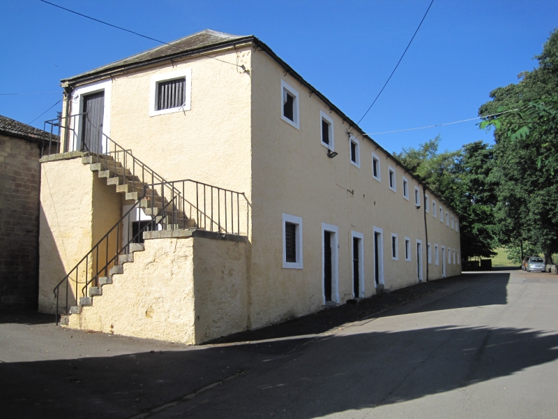
Stables, now storage rooms. Probably third quarter C18. Colour-washed render and ashlar dressings; Welsh slate roof. 2 storeys, 13 bays. Plain stone surrounds to 5 boarded doors, in second, third, fourth, seventh, and tenth bays; similar surrounds to boarded ground floor openings and 13 square loft openings with hit-and-miss slats. Hipped roof. Side steps on returns to first-floor doors, those on left return in 2 flights with plain wrought-iron balustrade. Dutch barn (q.v.) adjoins to centre rear.
Listing NGR: NZ1295122072
External links are from the relevant listing authority and, where applicable, Wikidata. Wikidata IDs may be related buildings as well as this specific building. If you want to add or update a link, you will need to do so by editing the Wikidata entry.


Other nearby listed buildings