Latitude: 54.6486 / 54°38'55"N
Longitude: -1.7401 / 1°44'24"W
OS Eastings: 416868
OS Northings: 528201
OS Grid: NZ168282
Mapcode National: GBR JG9P.2C
Mapcode Global: WHC57.7FM4
Plus Code: 9C6WJ7X5+FX
Entry Name: Farm Buildings C.200 Metres North-West of Green Field Farm
Listing Date: 30 September 1987
Grade: II
Source: Historic England
Source ID: 1121833
English Heritage Legacy ID: 111378
ID on this website: 101121833
Location: High Etherley, County Durham, DL14
County: County Durham
Civil Parish: Etherley
Traditional County: Durham
Lieutenancy Area (Ceremonial County): County Durham
Church of England Parish: Etherley
Church of England Diocese: Durham
Tagged with: Agricultural structure
ETHERLEY CHURCH STREET NZ 12 NE NZ 168282 (East side, off) High Etherley 5/13 Farm buildings c.200 metres north-west of Green Field farm
GV II
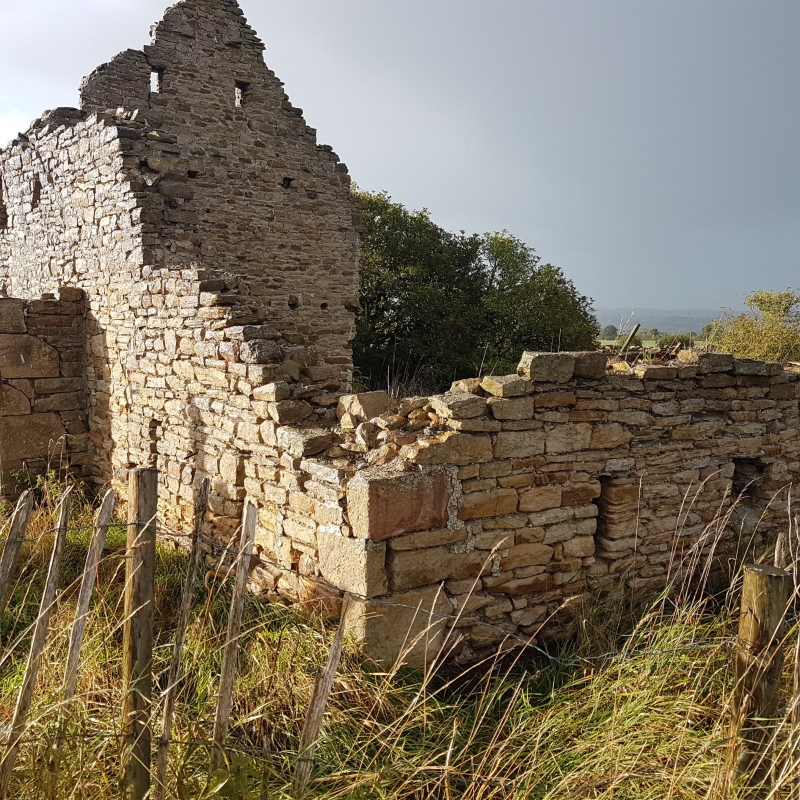
Farm buildings. Probably early C19. Sandstone rubble with quoins, ashlar and brick dressings; pantiled roof. Barn, shelter shed and cowhouse around 3 sides of a yard open to south; gin gang attached to barn on west.
Barn 2 storeys, 3 bays; other ranges one-storey, with 5 bays on north and 3 on east. Barn has flat stone lintel to empty door on side facing yard; similar lintel and flush sill to outer side blocked openings; 2 rows of vent slits in south gable with triangular coping blocks. Boarded doors in square gin gang to west with hipped roof.
North shelter shed has 4 elliptical brick arches on rubble piers; alternate openings blocked; west bay blank. Single near-centre door on east range. Interior not inspected.
Listing NGR: NZ1686828201
External links are from the relevant listing authority and, where applicable, Wikidata. Wikidata IDs may be related buildings as well as this specific building. If you want to add or update a link, you will need to do so by editing the Wikidata entry.


Other nearby listed buildings