Approximate Location Map
Large Map »
Latitude: 51.6951 / 51°41'42"N
Longitude: 0.1059 / 0°6'21"E
OS Eastings: 545641
OS Northings: 201690
OS Grid: TL456016
Mapcode National: GBR LFG.PL3
Mapcode Global: VHHML.SNBF
Plus Code: 9F32M4W4+28
Entry Name: 10 and 12, High Road
Listing Date: 14 January 1972
Grade: II
Source: Historic England
Source ID: 1124172
English Heritage Legacy ID: 117567
ID on this website: 101124172
Location: Epping, Epping Forest, Essex, CM16
County: Essex
District: Epping Forest
Civil Parish: Epping
Built-Up Area: Epping
Traditional County: Essex
Lieutenancy Area (Ceremonial County): Essex
Church of England Parish: Epping St John
Church of England Diocese: Chelmsford
Tagged with: Building
1.
1085 HIGH ROAD
Nos 10 & 12
TL 40 SE 2/61
II
2.
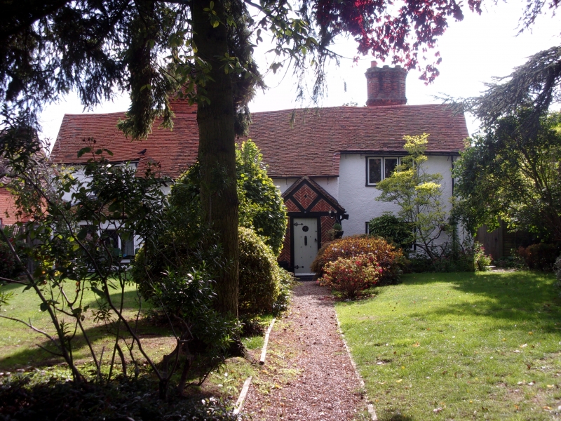
C16. Plaster whitewashed, old tile roof. 2 storeys, 3 casements.
Recased wings. 3 early stacks with diagonal shafts largely rebuilt to
original pattern.
Listing NGR: TL4564101690
External links are from the relevant listing authority and, where applicable, Wikidata. Wikidata IDs may be related buildings as well as this specific building. If you want to add or update a link, you will need to do so by editing the Wikidata entry.


Other nearby listed buildings
