Latitude: 51.5737 / 51°34'25"N
Longitude: -0.7744 / 0°46'27"W
OS Eastings: 485032
OS Northings: 186807
OS Grid: SU850868
Mapcode National: GBR D5W.91L
Mapcode Global: VHDWB.JPGY
Plus Code: 9C3XH6FG+F6
Entry Name: 46, Chapel Street
Listing Date: 31 January 1974
Grade: II
Source: Historic England
Source ID: 1125099
English Heritage Legacy ID: 46200
ID on this website: 101125099
Location: Marlow, Buckinghamshire, SL7
County: Buckinghamshire
Civil Parish: Marlow
Built-Up Area: Marlow
Traditional County: Buckinghamshire
Lieutenancy Area (Ceremonial County): Buckinghamshire
Church of England Parish: Great Marlow with Marlow Bottom, Little Marlow and Bisham
Church of England Diocese: Oxford
Tagged with: Building
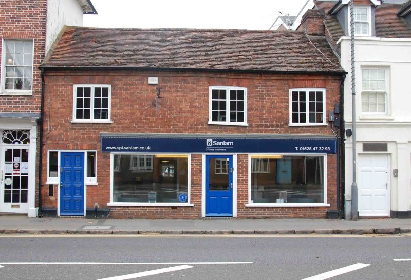
1.
1385
SU 8586
1/3
CHAPEL STREET
(South East Side)
No 46
II
2.
Late C18. 2 storeys. Red brick. Offset eaves. Old tile roof. 3
casements on 1st floor. Modern shop front almost the entire width of
the ground floor. Entrance on left side.
Listing NGR: SU8503286807
External links are from the relevant listing authority and, where applicable, Wikidata. Wikidata IDs may be related buildings as well as this specific building. If you want to add or update a link, you will need to do so by editing the Wikidata entry.


Other nearby listed buildings