Latitude: 52.0719 / 52°4'18"N
Longitude: -0.76 / 0°45'36"W
OS Eastings: 485085
OS Northings: 242227
OS Grid: SP850422
Mapcode National: GBR CZX.0P7
Mapcode Global: VHDT0.S621
Plus Code: 9C4X36CQ+QX
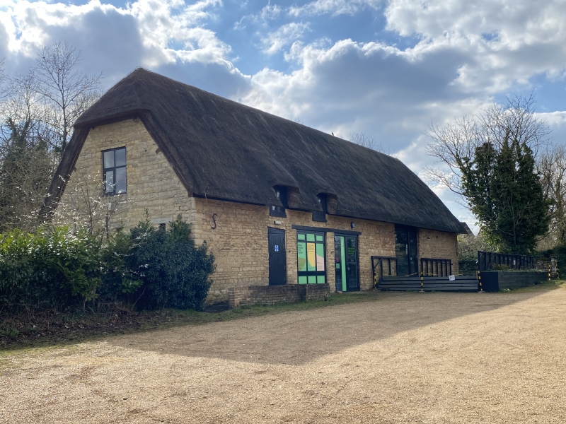
Entry Name: Barn to West of Linford Manor
Listing Date: 17 November 1966
Last Amended: 25 September 1985
Grade: II
Source: Historic England
Source ID: 1125238
English Heritage Legacy ID: 45826
ID on this website: 101125238
Location: Great Linford, Milton Keynes, Buckinghamshire, MK14
County: Milton Keynes
Civil Parish: Great Linford
Built-Up Area: Milton Keynes
Traditional County: Buckinghamshire
Lieutenancy Area (Ceremonial County): Buckinghamshire
Church of England Parish: Stantonbury and Willen
Church of England Diocese: Oxford
Tagged with: Barn Thatched barn
SP 84 SW GREAT LINFORD HIGH STREET north end
2/38 Barn to W. of Linford Manor (formerly listed as Barns at Manor House) 17.11.66
GV II
Barn on S. side of main W. axis. Cl8 stone, thatched roof (reconstructed after fire 1976).
Listing NGR: SP8508542227
External links are from the relevant listing authority and, where applicable, Wikidata. Wikidata IDs may be related buildings as well as this specific building. If you want to add or update a link, you will need to do so by editing the Wikidata entry.


Other nearby listed buildings