Latitude: 52.0482 / 52°2'53"N
Longitude: -0.7879 / 0°47'16"W
OS Eastings: 483219
OS Northings: 239564
OS Grid: SP832395
Mapcode National: GBR D01.KML
Mapcode Global: VHDT0.9SB6
Plus Code: 9C4X26X6+7R
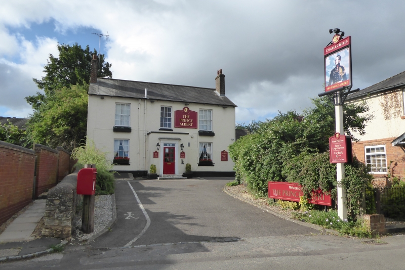
Entry Name: The Prince Albert Public House
Listing Date: 28 August 1975
Grade: II
Source: Historic England
Source ID: 1125269
English Heritage Legacy ID: 45799
ID on this website: 101125269
Location: Bradwell, Milton Keynes, Buckinghamshire, MK13
County: Milton Keynes
Civil Parish: Bradwell
Built-Up Area: Milton Keynes
Traditional County: Buckinghamshire
Lieutenancy Area (Ceremonial County): Buckinghamshire
Church of England Parish: Stantonbury and Willen
Church of England Diocese: Oxford
Tagged with: Pub
SP 83 NW BRADWELL VICARAGE ROAD
south side
3/12 The Prince Albert P.H.
28.8.75
II
Public House. Early C19., painted stucco, slate roof, flanking chimneys.
N. front has 3 bays, central modern porch, barred sash windows in
reveals with slightly cambered heads.
Listing NGR: SP8321939564
External links are from the relevant listing authority and, where applicable, Wikidata. Wikidata IDs may be related buildings as well as this specific building. If you want to add or update a link, you will need to do so by editing the Wikidata entry.


Other nearby listed buildings