Latitude: 52.0485 / 52°2'54"N
Longitude: -0.7872 / 0°47'13"W
OS Eastings: 483266
OS Northings: 239593
OS Grid: SP832395
Mapcode National: GBR D01.KSZ
Mapcode Global: VHDT0.9SP0
Plus Code: 9C4X26X7+94
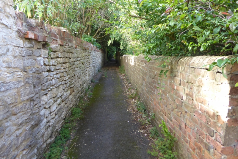
Entry Name: Two Walls from Vicarage Lane to Alexandra Court
Listing Date: 28 August 1975
Grade: II
Source: Historic England
Source ID: 1159900
English Heritage Legacy ID: 45797
ID on this website: 101159900
Location: Bradwell, Milton Keynes, Buckinghamshire, MK13
County: Milton Keynes
Civil Parish: Bradwell
Built-Up Area: Milton Keynes
Traditional County: Buckinghamshire
Lieutenancy Area (Ceremonial County): Buckinghamshire
Church of England Parish: Stantonbury and Willen
Church of England Diocese: Oxford
Tagged with: Wall
SP 83 NW BRADWELL VICARAGE ROAD south side
3/10 Two walls, from Vicarage Lane to No.9 Alexandra Court 28.8.75
II
Walls either side of footpath. Cl9, E. wall rubble stone, with stepped brick capping, forms boundary to the Old Stables, Vicarage Road. W. wall brick with half-round capping forms boundary to No.1 Vicarage Road (q.v.)
Listing NGR: SP8326639593
External links are from the relevant listing authority and, where applicable, Wikidata. Wikidata IDs may be related buildings as well as this specific building. If you want to add or update a link, you will need to do so by editing the Wikidata entry.


Other nearby listed buildings