Latitude: 52.0435 / 52°2'36"N
Longitude: -0.8487 / 0°50'55"W
OS Eastings: 479056
OS Northings: 238965
OS Grid: SP790389
Mapcode National: GBR BYN.VMS
Mapcode Global: VHDSZ.7WNV
Plus Code: 9C4X25V2+9G
Entry Name: Almshouses South East of Church of All Saints
Listing Date: 28 October 1976
Grade: II
Source: Historic England
Source ID: 1125415
English Heritage Legacy ID: 45461
ID on this website: 101125415
Location: Lower Weald, Milton Keynes, Buckinghamshire, MK19
County: Milton Keynes
Civil Parish: Calverton
Traditional County: Buckinghamshire
Lieutenancy Area (Ceremonial County): Buckinghamshire
Church of England Parish: Stony Stratford St Mary and Giles
Church of England Diocese: Oxford
Tagged with: Almshouse
1. 5135 Lower Weald Calverton Almshouses south-east of Church of All Saints SP 7938 4/100
II
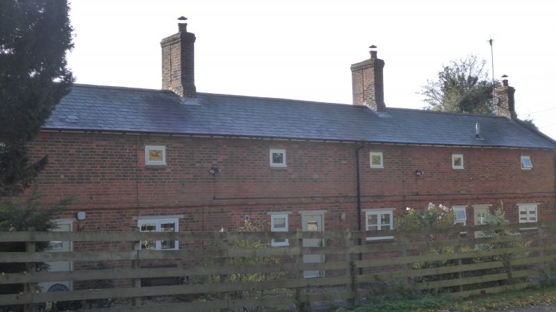
2. 1830. 3 reflected pairs, 2 storeys, 6 windows, brick. String course over ground floor. 3 paired doorways with depressed segmental arches, bracketted porches, slate covered; beaded plank doors. 6 windows, paired, on both floors, casements with stone drip moulds. 3 stone maltese crosses on 1st floor set in brick panels. Slate roof, verges with stone kneelers. 4 chimneys. Elevation to church has 2 storeys and 6 windows. Blocked paired windows with stone mullions, surrounds and labels on ground floor. Brick band over. Small lattice windows with cast-iron casements on 1st floor, stone drip moulds. West gable has plaque with label over bearing legend 'DEO AC PAUPERIEIIS MDCCCXXX'.
Listing NGR: SP7905638965
External links are from the relevant listing authority and, where applicable, Wikidata. Wikidata IDs may be related buildings as well as this specific building. If you want to add or update a link, you will need to do so by editing the Wikidata entry.


Other nearby listed buildings