Latitude: 51.6485 / 51°38'54"N
Longitude: -0.9084 / 0°54'30"W
OS Eastings: 475621
OS Northings: 194979
OS Grid: SU756949
Mapcode National: GBR C3D.R4G
Mapcode Global: VHDVW.6TMM
Plus Code: 9C3XJ3XR+CJ
Entry Name: Barn at Studdridge Farm
Listing Date: 4 July 1985
Grade: II
Source: Historic England
Source ID: 1125726
English Heritage Legacy ID: 46637
ID on this website: 101125726
Location: Buckinghamshire, HP14
County: Buckinghamshire
Civil Parish: Stokenchurch
Traditional County: Oxfordshire
Lieutenancy Area (Ceremonial County): Buckinghamshire
Church of England Parish: Lewknor
Church of England Diocese: Oxford
Tagged with: Barn
STOKENCHURCH IBSTONE ROAD SU 79 SE
6/158 Barn at Studdridge Farm - - II
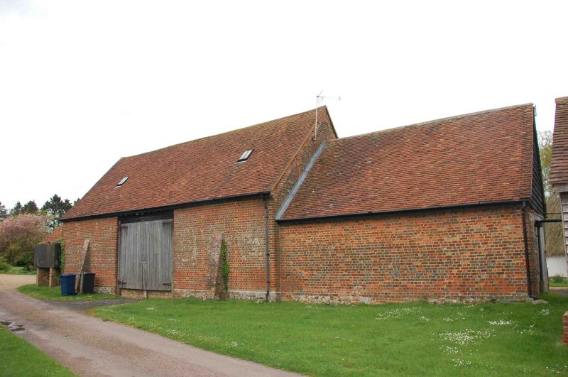
Barn. Late C18. Brick in English bond, old tile roof. 3 bays, the centre bay with gabled projecting cart entry. Catslide projections to flanking bays. Blocked vent slits to gables and rear, the rear also with central double doors. Curved principal trusses with slender raking struts to lower purlins. Lower section at far end with central stable door.
Listing NGR: SU7562194979
External links are from the relevant listing authority and, where applicable, Wikidata. Wikidata IDs may be related buildings as well as this specific building. If you want to add or update a link, you will need to do so by editing the Wikidata entry.


Other nearby listed buildings