Approximate Location Map
Large Map »
Latitude: 52.2047 / 52°12'16"N
Longitude: 0.1182 / 0°7'5"E
OS Eastings: 544843
OS Northings: 258391
OS Grid: TL448583
Mapcode National: GBR L79.LQW
Mapcode Global: VHHK3.0VB7
Plus Code: 9F426439+V7
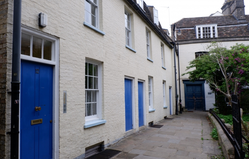
Entry Name: 12-15, St Edward's Passage
Listing Date: 2 November 1972
Grade: II
Source: Historic England
Source ID: 1126081
English Heritage Legacy ID: 47750
ID on this website: 101126081
Location: Cambridge, Cambridgeshire, CB2
County: Cambridgeshire
District: Cambridge
Electoral Ward/Division: Market
Parish: Non Civil Parish
Built-Up Area: Cambridge
Traditional County: Cambridgeshire
Lieutenancy Area (Ceremonial County): Cambridgeshire
Church of England Parish: Cambridge St Mary the Great with St Michael
Church of England Diocese: Ely
Tagged with: Building
ST EDWARD'S PASSAGE
1.
942
Nos 12 to 15 (consec)
TL 4458 SE 6/158
II GV
2.
Late C18/Early C19. Lime-washed brick. 2 storeys with attics 1 window
each sashes, some with glazing bars. Mensard tile roof.
All the listed buildings in St Edward's Passage form a group.
Listing NGR: TL4484358390
External links are from the relevant listing authority and, where applicable, Wikidata. Wikidata IDs may be related buildings as well as this specific building. If you want to add or update a link, you will need to do so by editing the Wikidata entry.


Other nearby listed buildings
