Latitude: 52.2092 / 52°12'33"N
Longitude: 0.1186 / 0°7'6"E
OS Eastings: 544854
OS Northings: 258895
OS Grid: TL448588
Mapcode National: GBR L79.DSK
Mapcode Global: VHHK3.0QJR
Plus Code: 9F426459+MC
Entry Name: 8, Portugal Place
Listing Date: 2 November 1972
Grade: II
Source: Historic England
Source ID: 1126097
English Heritage Legacy ID: 47703
ID on this website: 101126097
Location: Cambridge, Cambridgeshire, CB5
County: Cambridgeshire
District: Cambridge
Electoral Ward/Division: Market
Parish: Non Civil Parish
Built-Up Area: Cambridge
Traditional County: Cambridgeshire
Lieutenancy Area (Ceremonial County): Cambridgeshire
Church of England Parish: Cambridge St Clement
Church of England Diocese: Ely
Tagged with: House
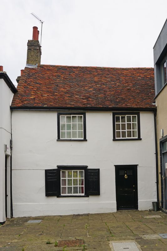
PORTUGAL PLACE 1. 942 (South-east Side) No 8 TL 4458 NE 3/627 II GV 2. C17, altered in the Cl8 and most of the features date from then. Timber-framed and plastered, 2 storeys, 2 windows, sliding sashes. Late Cl8 doors and staircase, Old tile roof. (RCHM 196). All the listed buildings in Portugal Place form a group.
Listing NGR: TL4485458894
External links are from the relevant listing authority and, where applicable, Wikidata. Wikidata IDs may be related buildings as well as this specific building. If you want to add or update a link, you will need to do so by editing the Wikidata entry.


Other nearby listed buildings