Approximate Location Map
Large Map »
Latitude: 52.5588 / 52°33'31"N
Longitude: -0.2303 / 0°13'49"W
OS Eastings: 520065
OS Northings: 297137
OS Grid: TL200971
Mapcode National: GBR HZX.GLJ
Mapcode Global: WHHNK.FYK6
Plus Code: 9C4XHQ59+GV
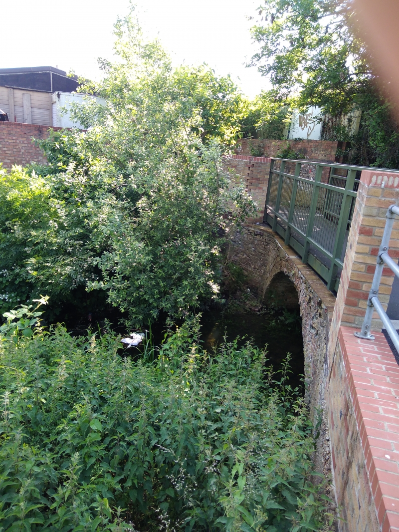
Entry Name: Bridge over Stanground Lode to North of South Street
Listing Date: 24 February 1982
Grade: II
Source: Historic England
Source ID: 1126703
English Heritage Legacy ID: 50233
ID on this website: 101126703
Location: Old Fletton, Peterborough, Cambridgeshire, PE2
County: City of Peterborough
Electoral Ward/Division: Fletton and Stanground
Parish: Non Civil Parish
Built-Up Area: Peterborough
Traditional County: Huntingdonshire
Lieutenancy Area (Ceremonial County): Cambridgeshire
Church of England Parish: Stanground
Church of England Diocese: Ely
Tagged with: Bridge
1.
5141 EX-OLD FIETTON UD STANGROUND LODE
Stanground
Bridge over Stanground
Lode to north of
South Street
TL 2097 52/551
II
2.
Dated 1790. Small brick round arched footbridge, single span. Stone keyblock
on south side with date 1790. The parapets have been rebuilt recently in brick
to a large extent.
RCHM (2) page 74.
Listing NGR: TL2006597137
External links are from the relevant listing authority and, where applicable, Wikidata. Wikidata IDs may be related buildings as well as this specific building. If you want to add or update a link, you will need to do so by editing the Wikidata entry.


Other nearby listed buildings
