Latitude: 52.2588 / 52°15'31"N
Longitude: 0.0042 / 0°0'15"E
OS Eastings: 536890
OS Northings: 264183
OS Grid: TL368641
Mapcode National: GBR K57.7XC
Mapcode Global: VHHJV.1H38
Plus Code: 9F427253+GM
Entry Name: Parish Church of All Saints
Listing Date: 31 August 1962
Grade: II*
Source: Historic England
Source ID: 1127241
English Heritage Legacy ID: 50994
Also known as: All Saints, Lolworth
ID on this website: 101127241
Location: All Saints' Church, Lolworth, South Cambridgeshire, CB23
County: Cambridgeshire
District: South Cambridgeshire
Civil Parish: Lolworth
Traditional County: Cambridgeshire
Lieutenancy Area (Ceremonial County): Cambridgeshire
Church of England Parish: Lolworth All Saints
Church of England Diocese: Ely
Tagged with: Church building
TL 36SE LOLWORTH CHURCH LANE (East Side)
10/88 Parish Church 31.8.62 of All Saints
II*
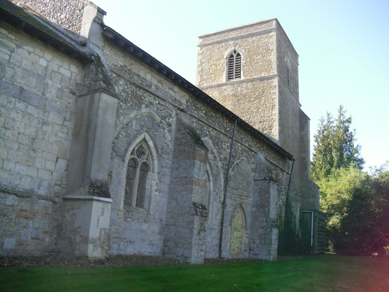
Parish church. Early C12 and C13 re-used stone fragments. Chancel and blocked north and south aisles early C14; later C14 tower. South porch rebuilt 1902. Restorations 1891 and 1914-18. Walls of limestone rubble, fieldstones, brick and re-used ashlar; dressings of freestone and clunch; slate roofs. South elevation. West tower of two stages with plain parapet and angle buttresses and moulded plinth band. Belfry window of two-cinquefoil-lights and quatrefoil. Blocked arcades of four bays with clunch infill and brick repairs, three reset late C14 aisle windows each of three-cinquefoil lights in four-centred arches with labels. South porch modern; south doorway, two-centred arch with continuous mouldings also reset. Chancel reduced in length, east wall C19, large two-light flat-arched window, priest's door with continuous moulded two-centred arch and jambs. Interior. C14 tower and chancel arches. C19 roofs; boarded five bayed nave roof with crown posts. Gaps in nave arcade blocking show octagonal clunch piers with moulded caps, and two-centred arches. Interior wall of tower lined with clunch, graffiti on tower arch, C16 belfry stair door. Chancel reduced in height, original windows blocked with splays and springing of rear arches visible. Font, late C14 clunch octagonal bowl with quatrefoil panels. Fragments of medieval screen in tower. Church yard cross base in nave with socket for shaft. C13 coffin lid reset in tower floor. Brass to Margaret Cutts 1610, for other monuments see R.C.H.M. Panel painting of Raising of Lazarus, Flemish, C17. Royal arms 'GR 1721' in pediment, and decalogue, reproduced 1983, from original in tower. C19 memorial glass. Wall painting, C14, of Doubting Thomas, on nave wall now painted over. The Church is said to have been re-dedicated in 1406; much of the village was burnt in a fire in 1393. Cole MSS. CRO. R.C.H.M. West Cambs mon.l, p.170 Pevsner. Buildings of England p.431
Listing NGR: TL3689064183
External links are from the relevant listing authority and, where applicable, Wikidata. Wikidata IDs may be related buildings as well as this specific building. If you want to add or update a link, you will need to do so by editing the Wikidata entry.


Other nearby listed buildings