Approximate Location Map
Large Map »
Latitude: 52.0921 / 52°5'31"N
Longitude: 0.1594 / 0°9'33"E
OS Eastings: 548034
OS Northings: 245949
OS Grid: TL480459
Mapcode National: GBR L8P.YYV
Mapcode Global: VHHKP.QP42
Plus Code: 9F4235R5+RQ
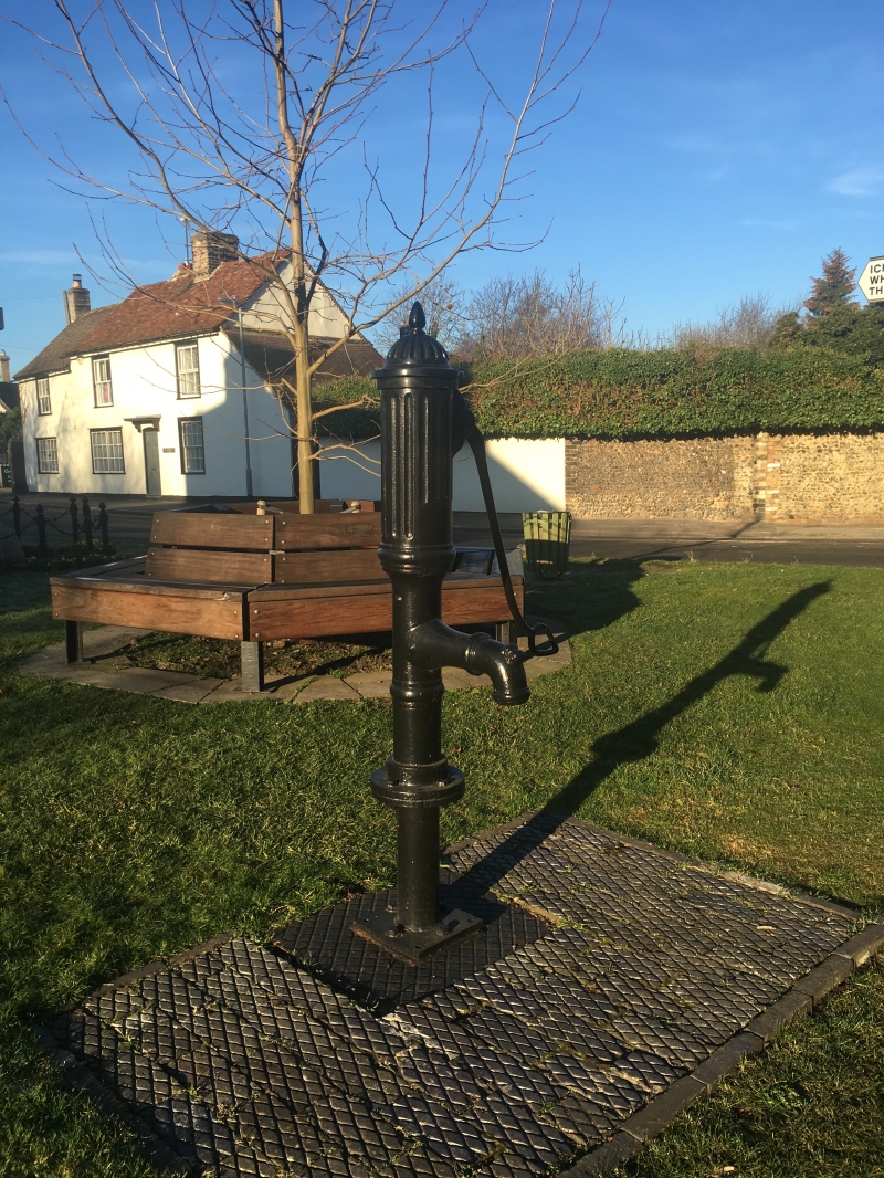
Entry Name: Village Pump on Small Green at Junction with St Peter's Street
Listing Date: 17 December 1986
Grade: II
Source: Historic England
Source ID: 1128116
English Heritage Legacy ID: 52873
ID on this website: 101128116
Location: Duxford, South Cambridgeshire, CB22
County: Cambridgeshire
District: South Cambridgeshire
Civil Parish: Duxford
Built-Up Area: Duxford
Traditional County: Cambridgeshire
Lieutenancy Area (Ceremonial County): Cambridgeshire
Church of England Parish: Duxford St Peter
Church of England Diocese: Ely
Tagged with: Well
TL 4845 DUXFORD CHAPEL STREET
20/43 Village Pump on
small green at
junction with St
Peter's Street
GV II
Village pump. C19. Cast iron with fluted cap (dome missing) spout and
lever, situated over a well or cistern.
Listing NGR: TL4803445949
External links are from the relevant listing authority and, where applicable, Wikidata. Wikidata IDs may be related buildings as well as this specific building. If you want to add or update a link, you will need to do so by editing the Wikidata entry.


Other nearby listed buildings
