Latitude: 52.1351 / 52°8'6"N
Longitude: -0.0614 / 0°3'40"W
OS Eastings: 532782
OS Northings: 250301
OS Grid: TL327503
Mapcode National: GBR K6P.39D
Mapcode Global: VHGMX.WLFM
Plus Code: 9C4X4WPQ+2F
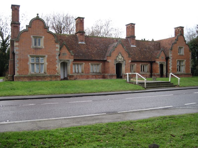
Entry Name: Countess of Hardwicke Almhouses
Listing Date: 16 July 1979
Last Amended: 3 September 1986
Grade: II
Source: Historic England
Source ID: 1128200
English Heritage Legacy ID: 52674
ID on this website: 101128200
Location: Arrington, South Cambridgeshire, SG8
County: Cambridgeshire
District: South Cambridgeshire
Civil Parish: Arrington
Traditional County: Cambridgeshire
Lieutenancy Area (Ceremonial County): Cambridgeshire
Church of England Parish: Arrington St Nicholas
Church of England Diocese: Ely
Tagged with: Building
ARRINGTON ERMINE WAY TL 3250 (West side) 15/10 Nos 123, 125, 127, 16.7.79 129 (Countess of Hardwicke Almshouses) (formerly listed as Nos 119-129)
GV II
Six almshouses, now four. 1846 to the design of H E Kendall for Susan, fourth Countess of Hardwicke, in memory of her mother. Red brick and Ketton limestone dressings. Fishscale patterned tiled roof. Four symmetrically disposed ridge stacks, reproducing those of C17, with panelled sides in arched heads, stone dressings and entablature. Single range with wings at north and south ends. Single storey main range has a central porch with shaped gable parapet with shield of arms of Earls of Hardwicke to the tympanum. Four centred arch in square head with stepped stone label. Adjacent doorways with original boarded doors, cover strips and iron furniture. Four, three-light casements. Wings are of two storeys with shaped gable end parapets and rusticated stone quoins. Each has a casement at first floor and a three-light cross-frame casement at ground floor. Gabled porch in each angle, with similar adjacent doorways, one now blocked. There is a paved stone terrace on the front approached by a flight of three steps.
RCHM: West Cambs mon (8)
Listing NGR: TL3278250301
External links are from the relevant listing authority and, where applicable, Wikidata. Wikidata IDs may be related buildings as well as this specific building. If you want to add or update a link, you will need to do so by editing the Wikidata entry.


Other nearby listed buildings