Latitude: 51.5679 / 51°34'4"N
Longitude: -2.4016 / 2°24'5"W
OS Eastings: 372259
OS Northings: 185520
OS Grid: ST722855
Mapcode National: GBR JZ.DJKW
Mapcode Global: VH95M.BV6G
Plus Code: 9C3VHH9X+49
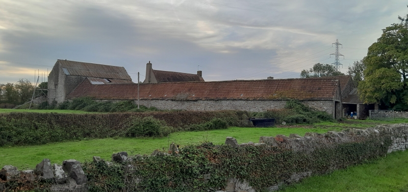
Entry Name: Lattimore Farmhouse and Attached Barn and Shelter Sheds and Service Wing
Listing Date: 5 June 1984
Grade: II
Source: Historic England
Source ID: 1128751
English Heritage Legacy ID: 34839
ID on this website: 101128751
Location: South Gloucestershire, BS37
County: South Gloucestershire
Civil Parish: Yate
Traditional County: Gloucestershire
Lieutenancy Area (Ceremonial County): Gloucestershire
Church of England Parish: Yate
Church of England Diocese: Bristol
Tagged with: Farmhouse
ST 78 NW YATE BURY HILL (south side)
4/215 Lattimore Farmhouse, and attached Barn and Shelter Sheds - and Service Wing II
Farmhouse. Early C18. Rendered; plain tiled roof with lowest 2 courses of stone slates. 3 storeys. Three 2- and 3-light casement windows, under dripmoulds on ground floor. Central panelled door in projecting porch. To the left is an attached barn: late C18/early C19; rubble with corrugated iron roof; projecting westwards from the barn is a row of sheltersheds with 3 plank doors and windows with affixed shutters. To the right and projecting westward is the service wing; probably a dairy and bakehouse: single storey; 3 plank doors and three 3-light casement windows, some with ovolo moulded mullions.
Listing NGR: ST7225985520
External links are from the relevant listing authority and, where applicable, Wikidata. Wikidata IDs may be related buildings as well as this specific building. If you want to add or update a link, you will need to do so by editing the Wikidata entry.


Other nearby listed buildings