Approximate Location Map
Large Map »
Latitude: 51.5087 / 51°30'31"N
Longitude: -2.5187 / 2°31'7"W
OS Eastings: 364100
OS Northings: 178985
OS Grid: ST641789
Mapcode National: GBR JT.J55F
Mapcode Global: VH88H.9BBT
Plus Code: 9C3VGF5J+FG
Entry Name: Oakleigh
Listing Date: 3 August 1984
Grade: II
Source: Historic England
Source ID: 1128849
English Heritage Legacy ID: 35079
ID on this website: 101128849
Location: Hambrook, South Gloucestershire, BS16
County: South Gloucestershire
Civil Parish: Winterbourne
Built-Up Area: Hambrook
Traditional County: Gloucestershire
Lieutenancy Area (Ceremonial County): Gloucestershire
Church of England Parish: Frenchay and Winterbourne Down
Church of England Diocese: Bristol
Tagged with: Building
ST 67 NW WINTERBOURNE BRISTOL ROAD (west side),
Hambrook
3/23
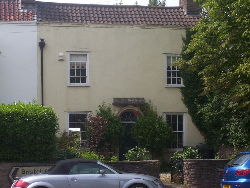
Oakleigh
G.V.
II
House in a short terrace. Mid/late C18. Roughcast, pantile roof.
2 storeys, 2 windows, all glazing bar sashes, central 6-panel under semi-
circular fanlight in round-headed frame with panelled pilasters and moulded
arch, parapet with moulded coping.
Listing NGR: ST6410078985
External links are from the relevant listing authority and, where applicable, Wikidata. Wikidata IDs may be related buildings as well as this specific building. If you want to add or update a link, you will need to do so by editing the Wikidata entry.


Other nearby listed buildings
