Latitude: 51.4392 / 51°26'21"N
Longitude: -2.7816 / 2°46'53"W
OS Eastings: 345769
OS Northings: 171425
OS Grid: ST457714
Mapcode National: GBR JG.NK10
Mapcode Global: VH7C8.Q3V1
Plus Code: 9C3VC6Q9+M9
Entry Name: Cross Base and Shaft in the Churchyard About 14 Metres South of the Tower of St Quiricus and St Julietta
Listing Date: 20 January 1986
Grade: II
Source: Historic England
Source ID: 1129122
English Heritage Legacy ID: 33760
ID on this website: 101129122
Location: North Somerset, BS21
County: North Somerset
Civil Parish: Tickenham
Traditional County: Somerset
Lieutenancy Area (Ceremonial County): Somerset
Tagged with: Building
ST 47 SE
4/97
TICKENHAM C.P.
CHURCH LANE (north side)
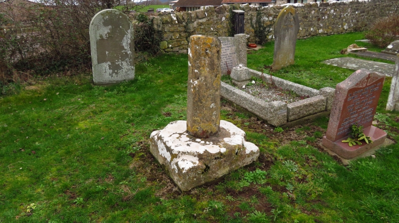
Cross base and shaft in the churchyard about 14 metres south of tower of Church of St. Quiricus and St. Julietta
G.V.
II
Cross base and shaft. Probably C14. Limestone. Square plinth with octagonal
base for cross, polygonal shaft about 1/2 metre high.
Listing NGR: ST4576971425
External links are from the relevant listing authority and, where applicable, Wikidata. Wikidata IDs may be related buildings as well as this specific building. If you want to add or update a link, you will need to do so by editing the Wikidata entry.


Other nearby listed buildings