Approximate Location Map
Large Map »
Latitude: 51.5383 / 51°32'17"N
Longitude: -2.398 / 2°23'52"W
OS Eastings: 372494
OS Northings: 182230
OS Grid: ST724822
Mapcode National: GBR JZ.GCJ0
Mapcode Global: VH95T.DL4L
Plus Code: 9C3VGJQ2+8R
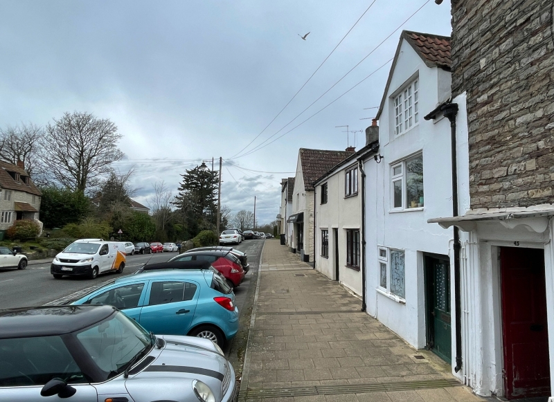
Entry Name: 43, Rounceval Street
Listing Date: 29 July 1983
Grade: II
Source: Historic England
Source ID: 1129302
English Heritage Legacy ID: 34191
ID on this website: 101129302
Location: Chipping Sodbury, South Gloucestershire, BS37
County: South Gloucestershire
Civil Parish: Sodbury
Built-Up Area: Chipping Sodbury
Traditional County: Gloucestershire
Lieutenancy Area (Ceremonial County): Gloucestershire
Church of England Parish: Chipping Sodbury St John the Baptist
Church of England Diocese: Gloucester
Tagged with: Building
ST 7282 SW SODBURY ROUNCEVAL STREET
4/141 (north side)
THE PARADE
No 43
GV
II
C17. Rendered, Double Roman tile roof. Two storeys and gabled attic. One window;
ground floor has oak-mullioned 3-light casement, first floor C20 replacement window.
Door opening of centre to right, with modern door.
Listing NGR: ST7249382233
External links are from the relevant listing authority and, where applicable, Wikidata. Wikidata IDs may be related buildings as well as this specific building. If you want to add or update a link, you will need to do so by editing the Wikidata entry.


Other nearby listed buildings
