Latitude: 51.3675 / 51°22'2"N
Longitude: -2.5796 / 2°34'46"W
OS Eastings: 359747
OS Northings: 163315
OS Grid: ST597633
Mapcode National: GBR JR.T1TR
Mapcode Global: VH891.7WML
Plus Code: 9C3V9C8C+X5
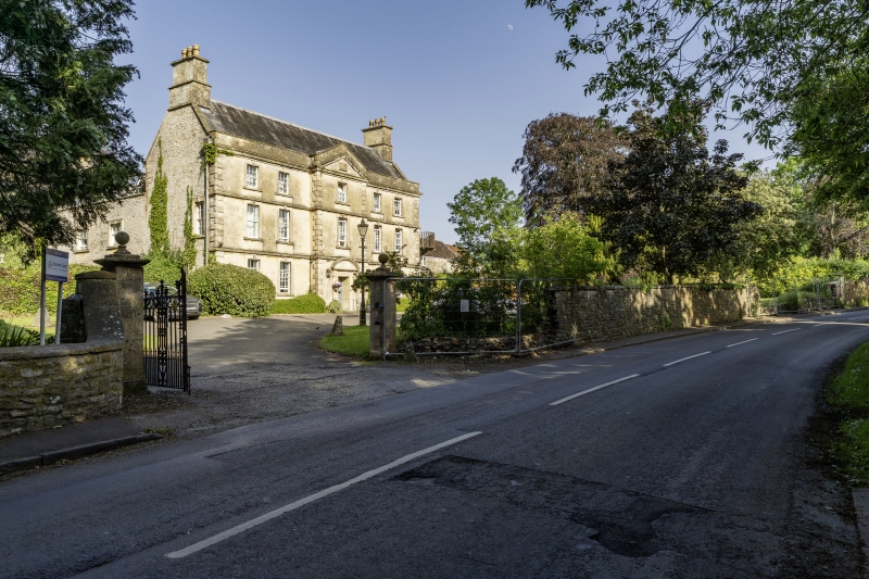
Entry Name: Wall, Piers and Gates About 16 Metres West of the Court
Listing Date: 4 December 1986
Grade: II
Source: Historic England
Source ID: 1129644
English Heritage Legacy ID: 32995
ID on this website: 101129644
ST 56 SE STANTON DREW C.P. BROMLEY ROAD (east side)
3/98 Wall, piers and gates about 16 metres west of The Court G.V. II
Wall, piers and gates. Mid C18 with C19 gates. Limestone and sandstone rubble with limestone coping to wall, ashlar piers, cast and wrought iron gates. Wall about 1½ metres high and about 55 metres long, to left and right a square pier about 2 metres high with cornice and ball finial on stem; to left, wall swept round to similar pair of entrance piers, gates have spear heads to lower rails and scroll work.
Listing NGR: ST5974763315
External links are from the relevant listing authority and, where applicable, Wikidata. Wikidata IDs may be related buildings as well as this specific building. If you want to add or update a link, you will need to do so by editing the Wikidata entry.


Other nearby listed buildings