Approximate Location Map
Large Map »
Latitude: 52.294 / 52°17'38"N
Longitude: -0.2525 / 0°15'8"W
OS Eastings: 519276
OS Northings: 267641
OS Grid: TL192676
Mapcode National: GBR J35.2ZH
Mapcode Global: VHGM1.KLWT
Plus Code: 9C4X7PVX+H2
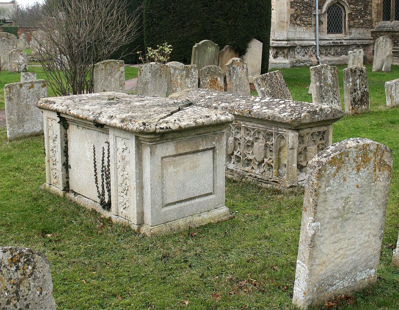
Entry Name: Table Tomb, South of Porch at St Mary's Parish Church
Listing Date: 3 June 1983
Grade: II
Source: Historic England
Source ID: 1130314
English Heritage Legacy ID: 54273
ID on this website: 101130314
Location: St Mary's Church, Buckden, Huntingdonshire, Cambridgeshire, PE19
County: Cambridgeshire
District: Huntingdonshire
Civil Parish: Buckden
Built-Up Area: Buckden
Traditional County: Huntingdonshire
Lieutenancy Area (Ceremonial County): Cambridgeshire
Church of England Parish: Buckden St Mary
Church of England Diocese: Ely
Tagged with: Architectural structure
TL 1967
5/2
BUCKDEN
CHURCH STREET
(NORTH SIDE)
TABLE TOMB, SOUTH OF PORCH AT ST. MARY'S PARISH CHURCH
GV
II
Table tomb, C15 or C16, with cusped panelling enclosing blank
shields with coped slab.
RCHM - Huntingdonshire, p34
Listing NGR: TL1927667641
External links are from the relevant listing authority and, where applicable, Wikidata. Wikidata IDs may be related buildings as well as this specific building. If you want to add or update a link, you will need to do so by editing the Wikidata entry.


Other nearby listed buildings
