Approximate Location Map
Large Map »
Latitude: 53.3544 / 53°21'15"N
Longitude: -2.6318 / 2°37'54"W
OS Eastings: 358040
OS Northings: 384351
OS Grid: SJ580843
Mapcode National: GBR BY2N.08
Mapcode Global: WH98Q.JYYB
Plus Code: 9C5V9939+P7
Entry Name: Moore Bridge
Listing Date: 31 October 1983
Grade: II
Source: Historic England
Source ID: 1130427
English Heritage Legacy ID: 55999
ID on this website: 101130427
Location: Moore, Halton, Cheshire, WA4
County: Halton
Civil Parish: Moore
Built-Up Area: Moore
Traditional County: Cheshire
Lieutenancy Area (Ceremonial County): Cheshire
Church of England Parish: Daresbury All Saints
Church of England Diocese: Chester
Tagged with: Bridge
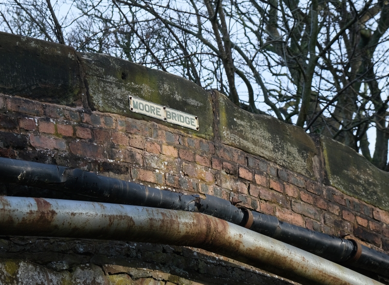
SJ 58 SE MOORE C.P. HOBB LANE
6/45 Moore Bridge
II
Road bridge over the Bridgewater Canal in Moore Village circa 1772 red brick
with stone carriage and parapet. Steeply humped and of only one vehicle width
but belled out both approaches. Exposed stone carriageway arch and springing
with brick soffite.
Listing NGR: SJ5804084351
External links are from the relevant listing authority and, where applicable, Wikidata. Wikidata IDs may be related buildings as well as this specific building. If you want to add or update a link, you will need to do so by editing the Wikidata entry.


Other nearby listed buildings
